
Well, I’ve been meaning to write this post for quite a while, but I’ve put it off for a number of reasons. Regardless, it’s time you hear about that time I was nearly at the top of the world.
It started with an overnight bus ride from Delhi to Manali. It really wasn’t horrible, but I wouldn’t do it again… All I remember is waking up every 30 minutes to the sound of India’s crazy musical truck horns… They’re funny. But in the middle of the night, especially in my state of lack of sleep and feeling already on edge, they were grating. Listen here for a few examples. At one point, the heat that the back of the bus was generating started heating all my belongings and making me feel disgusting. Eventually there was that “back of the bus smell” if you’ve ever shared that experience. I kept getting more and more irritable until I had that feeling like I just needed to get out before exploding. But that wasn’t an option. Thankfully, I had earphones slash music. And a little Jack Johnson did a lot of good. Finally, around 2 or 3am, a seat across the aisle opened up and I was able to lie down. Yay. Sleep! I still felt gross. But at least I was asleep.
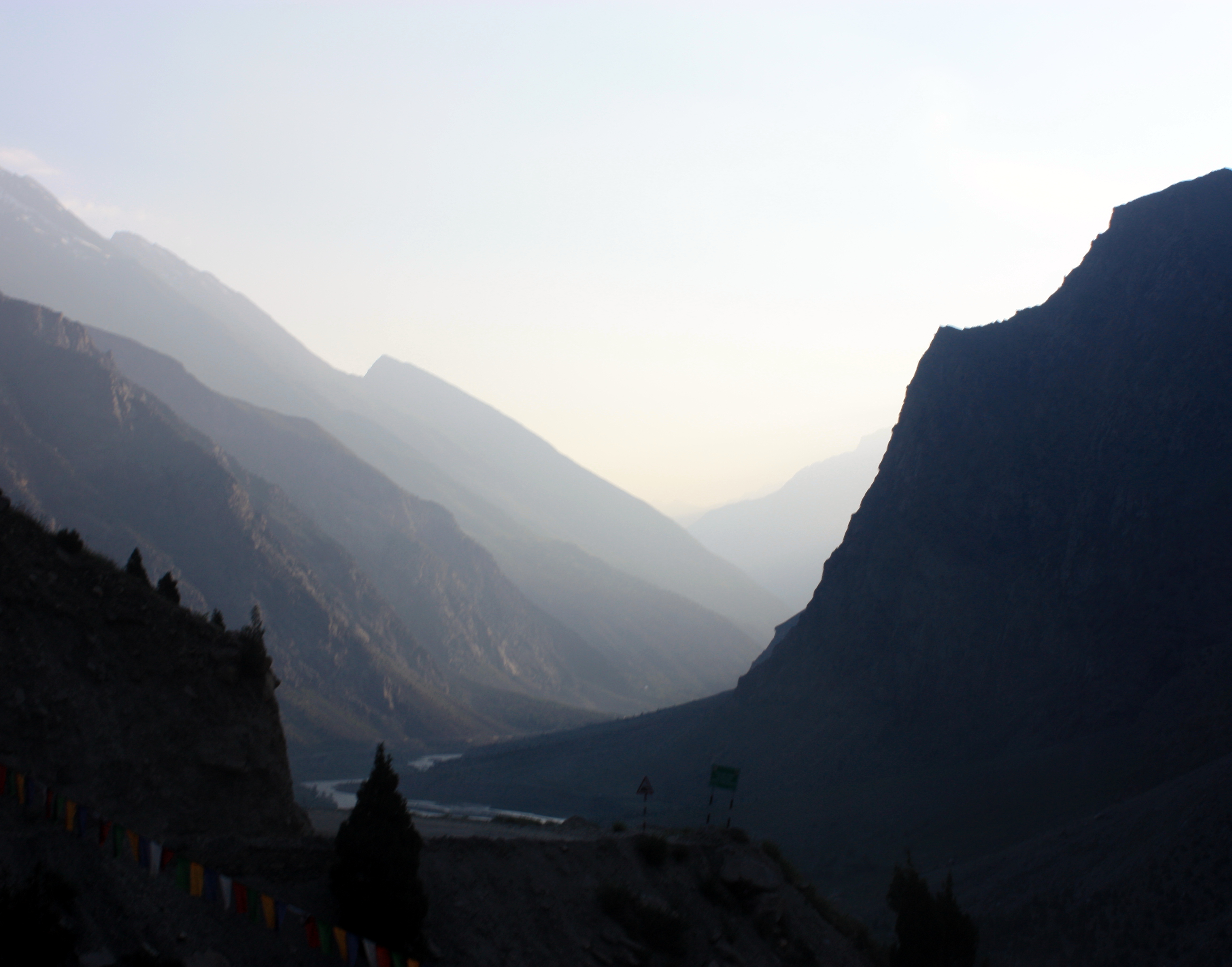
I woke up to a beautiful rushing river running beside the road and mountains on both sides. AWESOME. I could already feel the cool air outside when I pressed my hand against the window.
We arrived early at our Manali hotel before the sunrise. We each had a giant room with hot water and giant open windows so the breeze could blow through and great views. After napping, we spent the day in Manali. Honestly, it was one of my favorite days. If I was planning this trip again, we’d spend more days like that one. I hated Manali. But I loved the day. It was peaceful. For brunch, I had a delicious yak cheese omelet. Later, we hiked to a nearby historic temple and afterwards had tea along the river.

We actually had a lot of good laughs about Manali… It felt like this totally tourist town where all the westerners go to feel like they’re getting in touch with Indian culture and Eastern spiritualism but are too afraid to eat Indian food (which is delicious most of the time) or go to the crazy spots in India (which are typically the realistic ones). Though beautiful, peaceful, and perhaps enchanting, it was NOT “India” as most know it. Nothing spoke of Indian culture. Granted, India has many cultures and subcultures. But there were no saris, no chapati, no paneer, no laddu. Obviously mountain culture is different. This is obviously someone’s culture. But it was ironic that this is the town where everyone seemed to come to “experience India”. What a tiny piece of India. Everything seemed incredibly different from the rest of the places we’d been in India; and almost everything seemed geared towards tourists. We saw plenty of classes for tourists –> yoga. Yoga for breakfast. Yoga and meditation. Lots of restaurants serving hummus and pizza and “therapeutic teas”. There were a lot of people smoking various things.

At night, obnoxious music filled the town. But I enjoyed the slow pace for ourselves after having rushed around from place to place for nearly 2 weeks. I enjoyed the laughter. I enjoyed the relative peacefulness. I enjoyed the irony of all the westerners thinking they were soaking up Indian culture, when in reality, this was nothing close to what we think of as Indian culture.
Early the next morning, we started our trek up into the Himalayas…

We were able to hire a driver to take us one-way over the next 2 days, up through/over the Himalayas to Leh, our final destination, situated in a valley of the mountains, for an extremely reasonable price. And he was an excellent driver. He drove carefully enough that we weren’t scared (at least not scared by his driving skills), but fast enough that we weren’t going at a turtle’s pace.
It was going to take 2 full days to get all the way to Leh. Other than that I had literally zero details about what would happen in between.
DAY 1
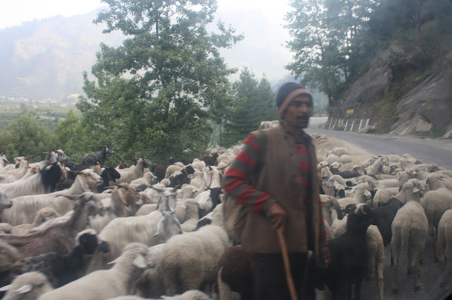
So, we started on our way. Manali is essentially at the same altitude as Denver. Throughout the drive, we had to stop for herds of animals trekking along the same road we were using.
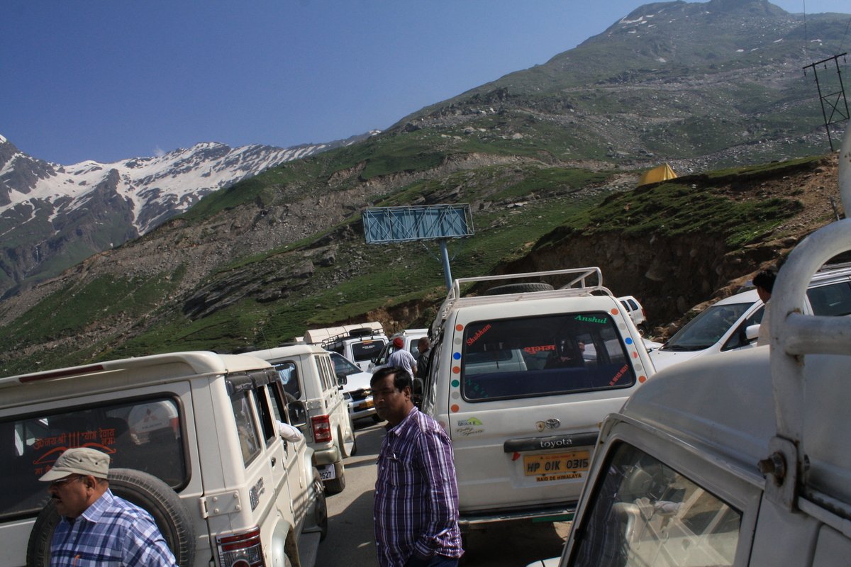
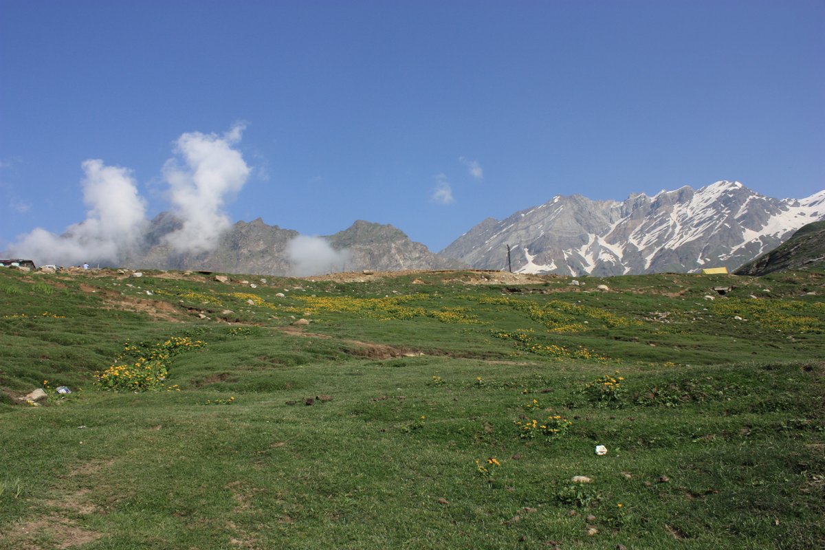
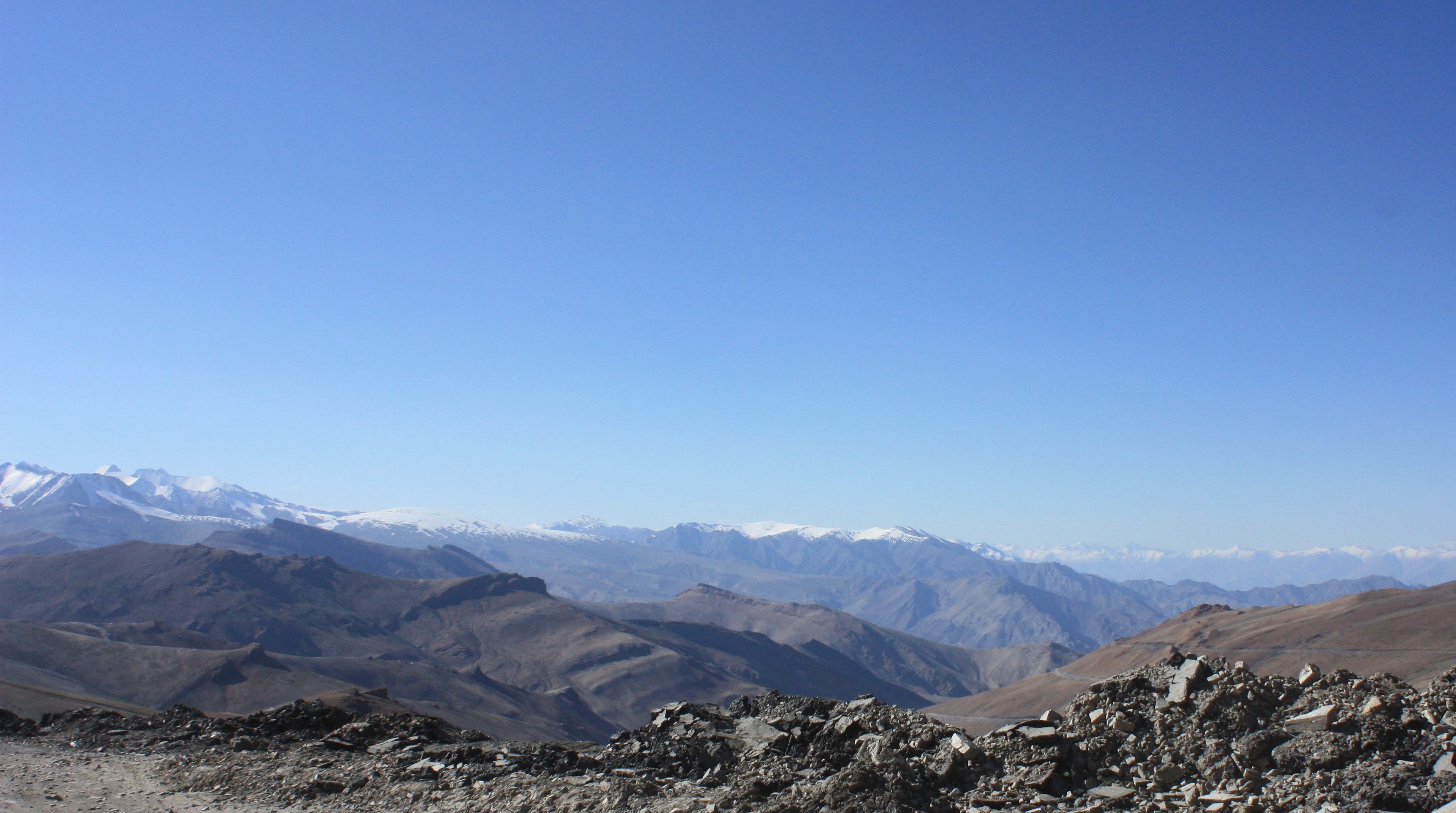
All went well for the first… 2 or 3 hours of the trip… until we came close to the first mountain pass. Rotang Pass. Around 13,000 feet. And traffic jam at around 11,000 feet just before the pass. No one seemed to know what the issue was (or maybe that was just us).
So we took the opportunity to get out and do a little exploring. Actually, I needed to go to the bathroom, and I could see a little shop just a short ways up the mountain. So instead of waiting for our taxi to wind all the way around the curve, we decided to get out and just walk a little ways up and meet our driver at the store location if traffic ever moved.
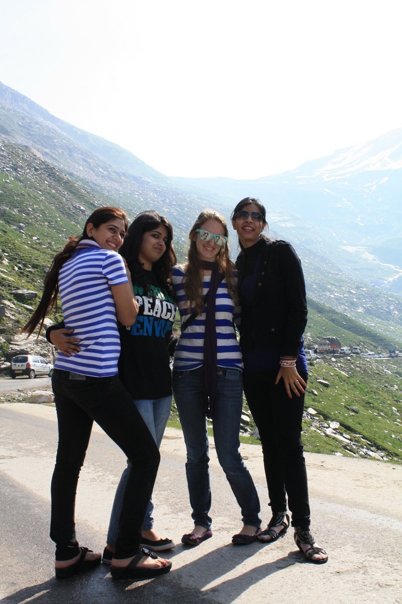
After the bathroom break, I made some friends while waiting for our driver to catch up with us. Naturally, as any fellow white traveler to India will understand, we took a picture.
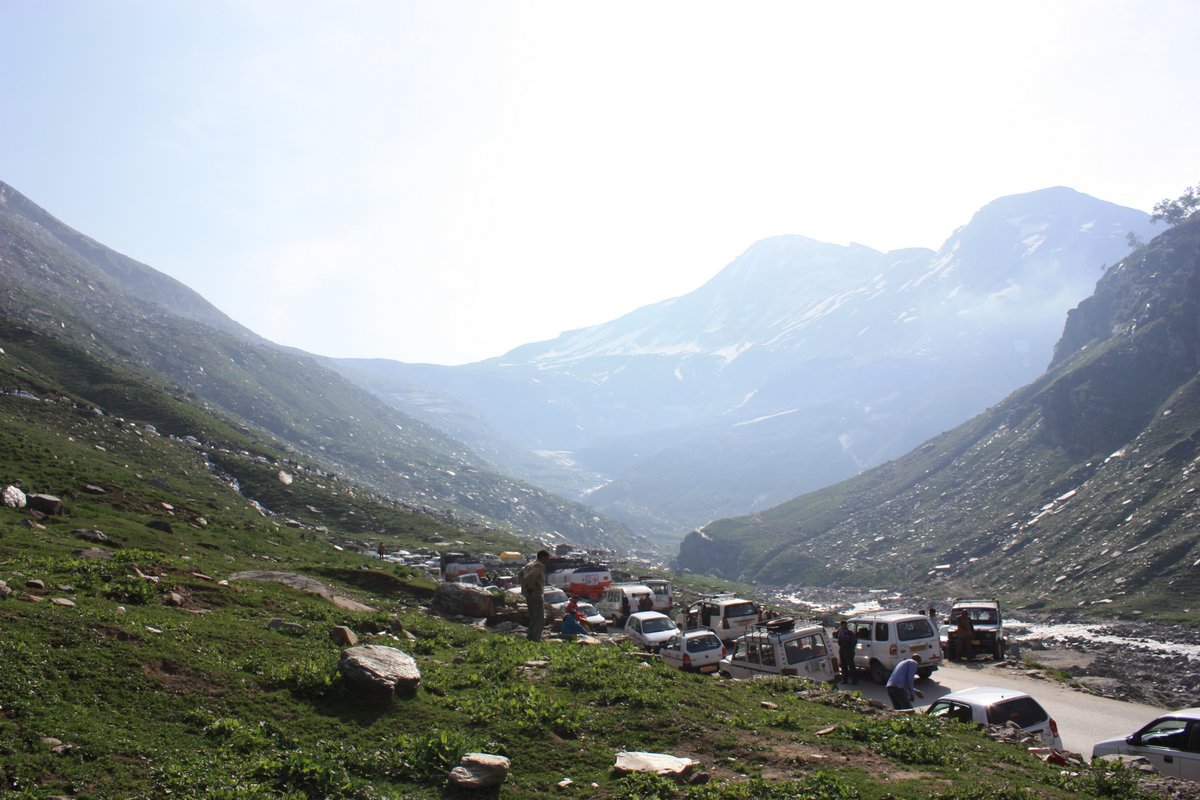
Finally traffic started moving and we managed to find our driver and hop back in the car. We drove smoothly for a few more miles, then again, traffic jam. This time was worse than before. Monster traffic jam. Now we were around 12,000 feet. Good thing I kept myself hydrated. We sat unmoving for nearly an hour. People were beginning to abandon their cars to make conversation or even tea with their neighbors. Locals from nearby villages had started making their way to our roads with things like nuts and saffron to sell.
At some point, we got wind that there had been an avalanche ahead. Part of me legitimately wondered if we’d be stuck there for days. (Which is not an illegitimate concern in India).
It was like the blocked road had all of a sudden become a village of its own. People plopped down on the side of the road to smoke. (Or some even in the middle of the road). Families got out and mom pulled out a package of food. Kids kicked soccer balls around. Some folks squatted on groups of giant boulders and chatted with their friends. Tea was served. Along with other beverages.
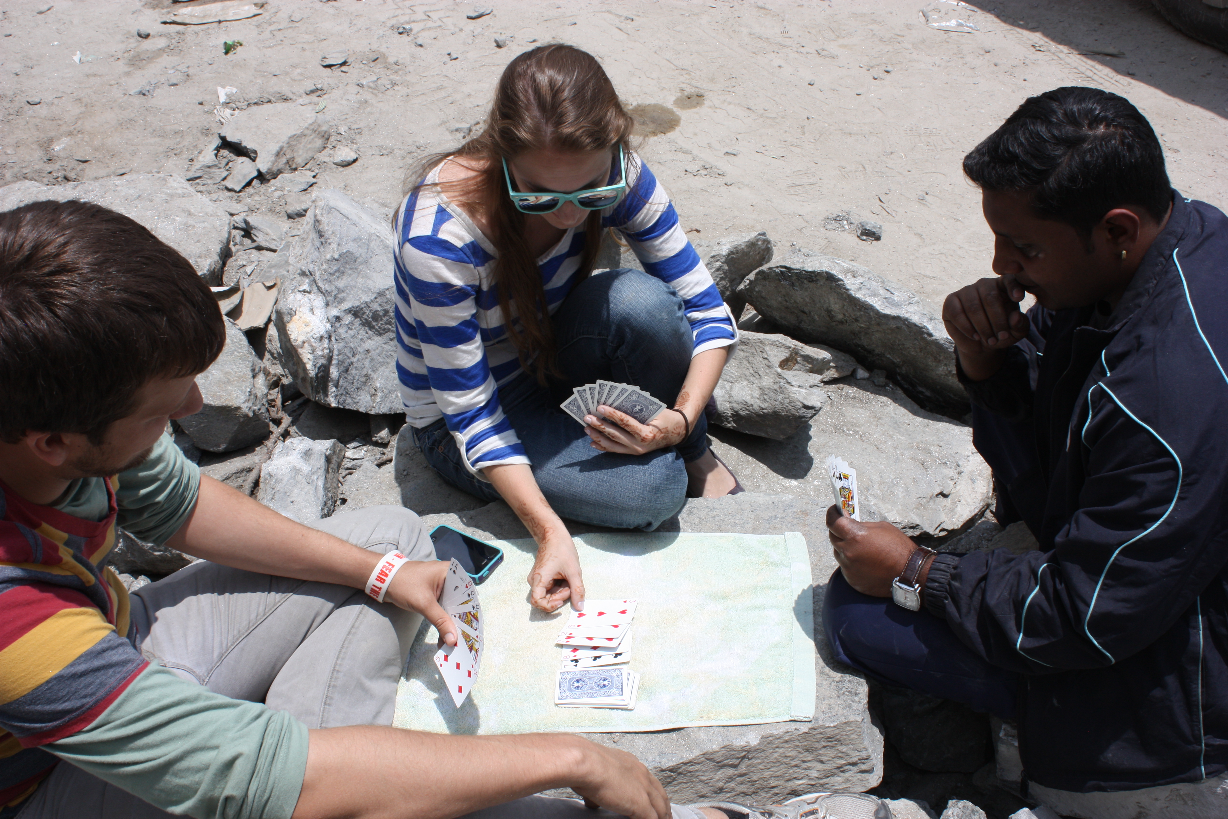
Eventually we got out of the car and planted ourselves in this, hopefully temporary, new city. We quickly made 2 Indian friends (Oh, we were basically the only foreigners in sight) and taught them gin rummy.
To be honest, I remember feeling really frustrated and eventually stir crazy being stuck on the side of a mountain. But now, I mostly remember it as an adventure.
2 hours… 3 hours… 4 hours passed. Still nothing. Should we start making plans to camp here? If you know anything about driving in India and then if you know anything about driving on curvy unpaved mountain roads you could easily guess my terror at the idea of driving around Indian curvy unpaved mountain roads in the dark. Well, good thing we had packed lots of bread and yak cheese from Manali. At least food would be ok for a while.
We did a little more of our own exploring on the mountain side, drinking in the fresh air, relatively free from the normal Indian city smog. We sat in the car and read a bit. We met our driver’s brother. Oh, and our car got hit by another car at one point. No biggie. Anything goes on the side of a mountain.
Finally, while up on a rock overlooking the stopped road, we noticed a bulldozer trying to make its way through the traffic. When it finally got through (over an hour later), we followed it and found the avalanche.
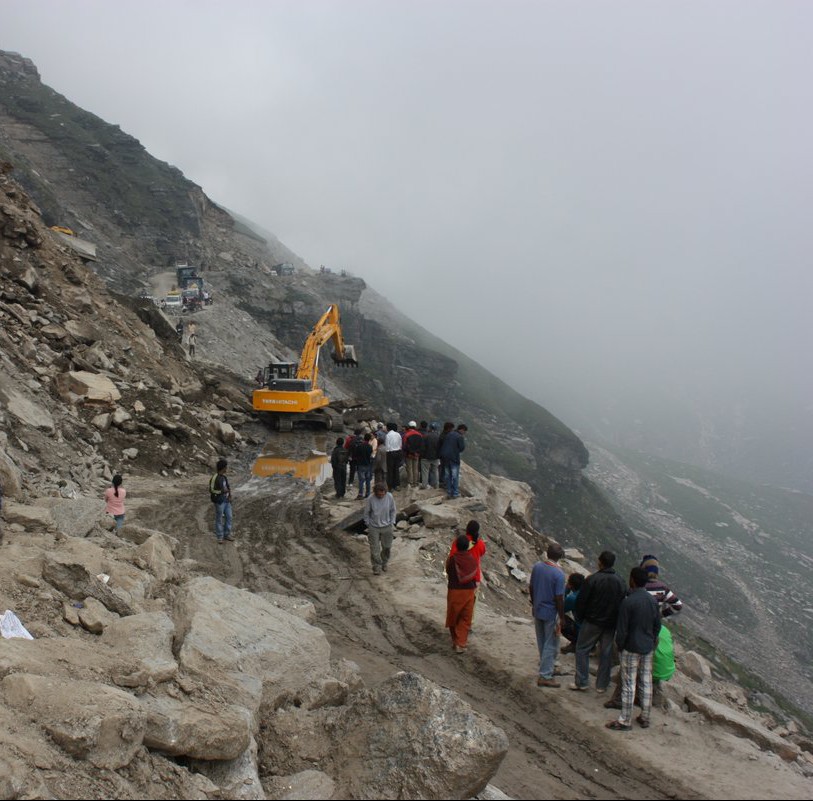
Luckily it had been a minor avalanche, and as far as we knew no one had been hurt.
6 hours later, the road was cleared. Well…. cleared is relative. By “cleared” I mean, “the rocks were gone”. That giant puddle of water and mud still existed. We weren’t sure if our jeep would make it through, but our driver was a pro at navigating sticky mountain situations and with a ferocious roar of the engine and a lot of splattered mud, we made it through.
The rest of the drive for that evening was relatively uneventful. We easily made it through Rohtang pass at 13,000 feet, then winded slowly back down to around 10,000 until we reached Keylong, where we would stay for the night.
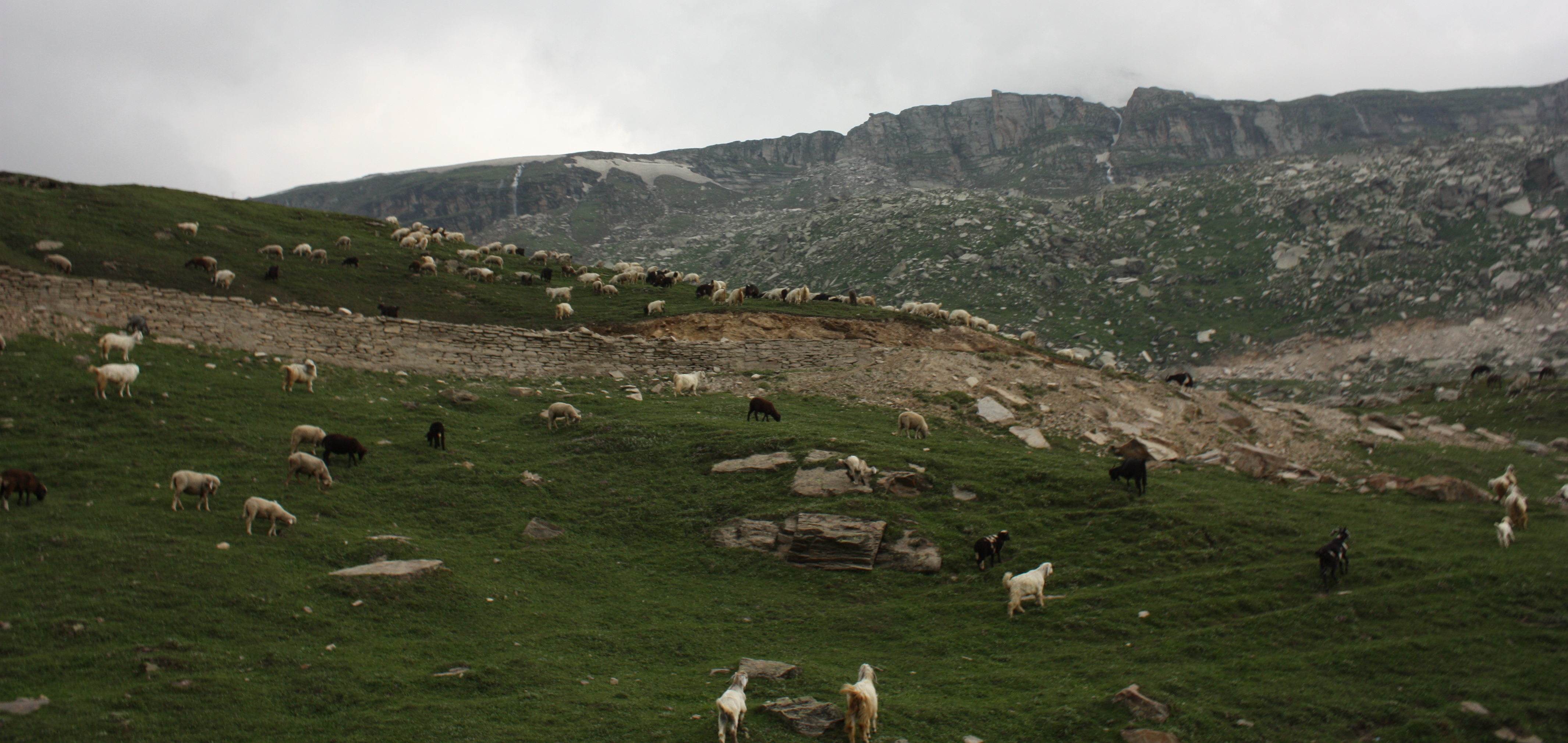
We passed about a gazillion goats.
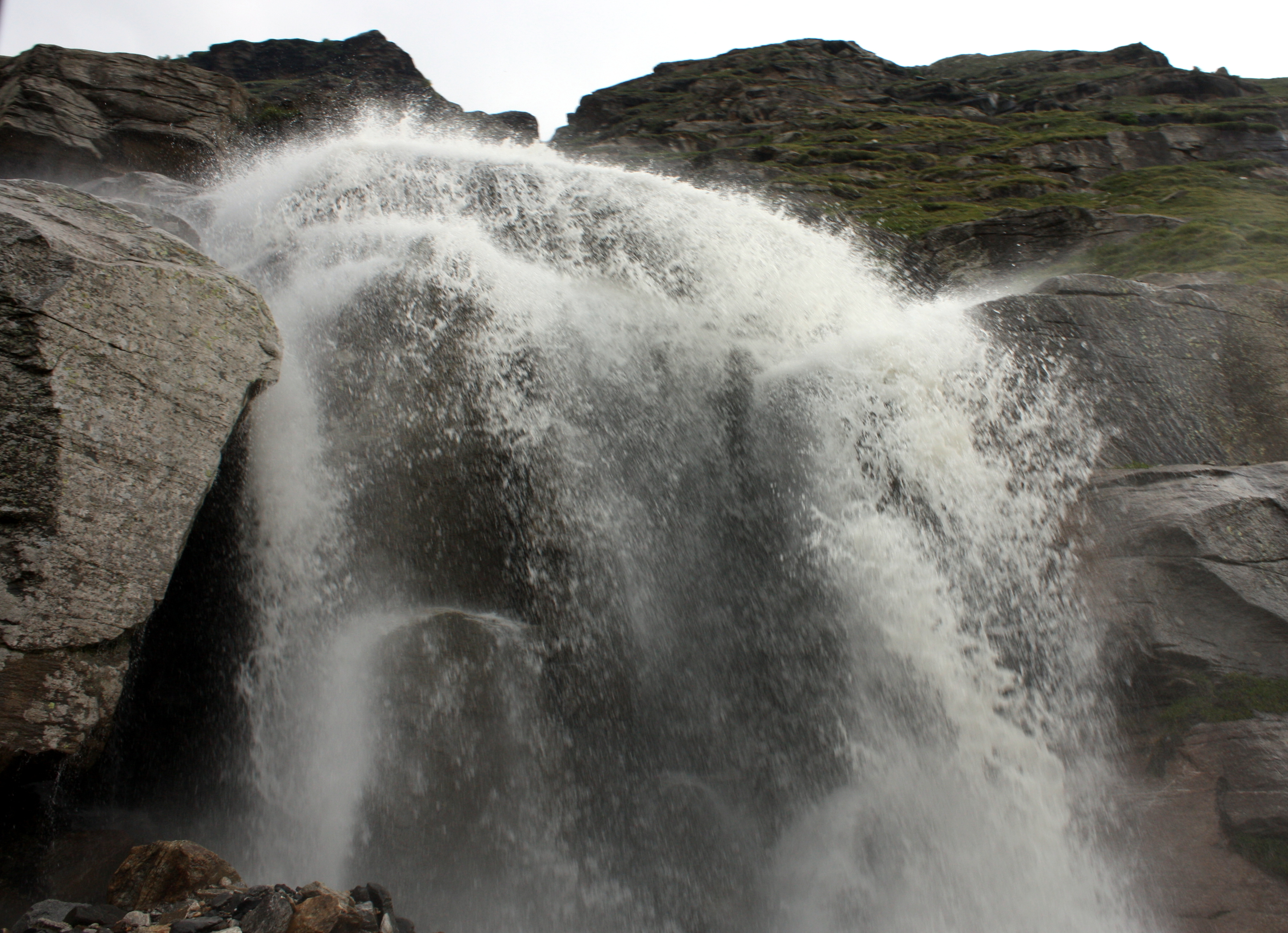
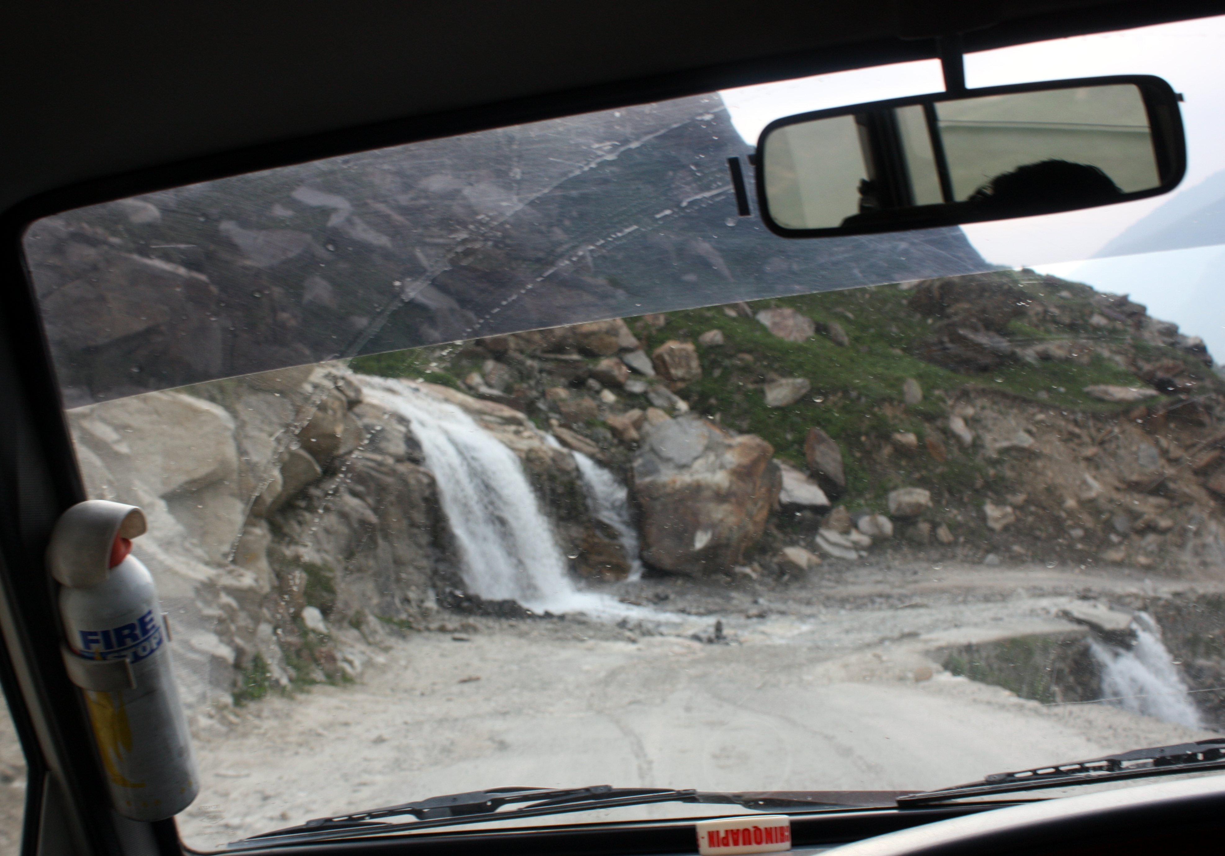
And drove through gushing waterfalls cascading over the road.
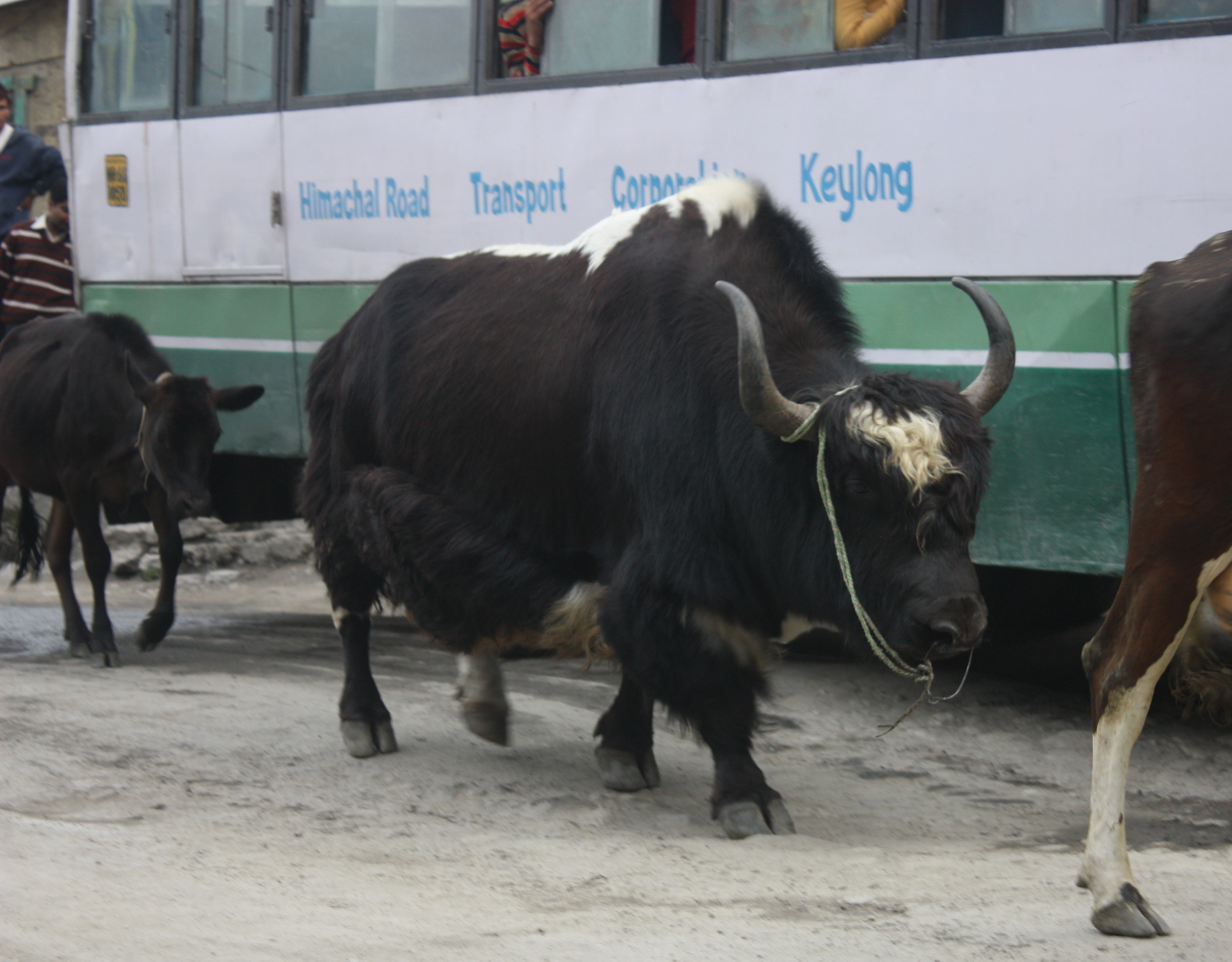
And I saw yaks for the first time in my life. That was exciting 🙂
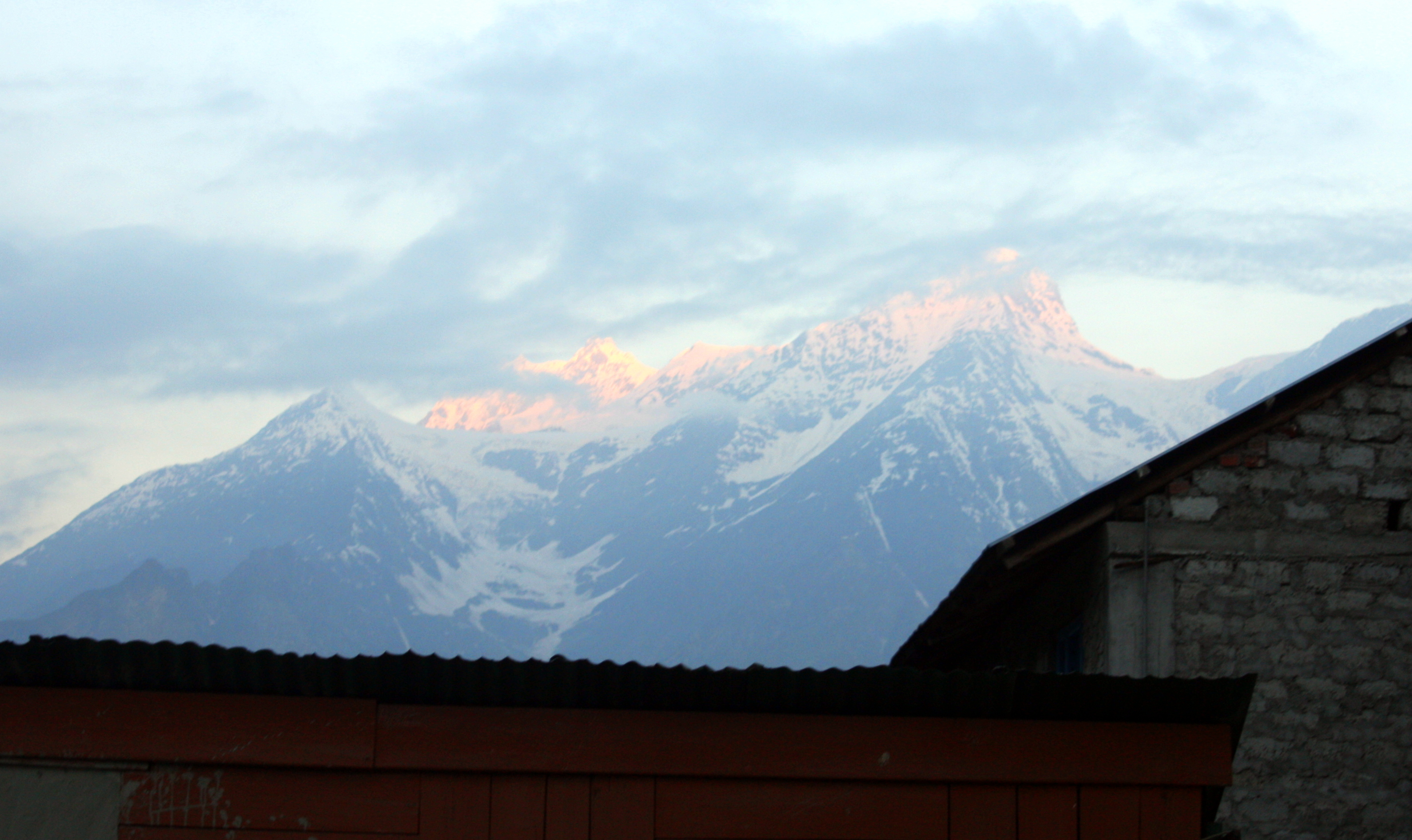
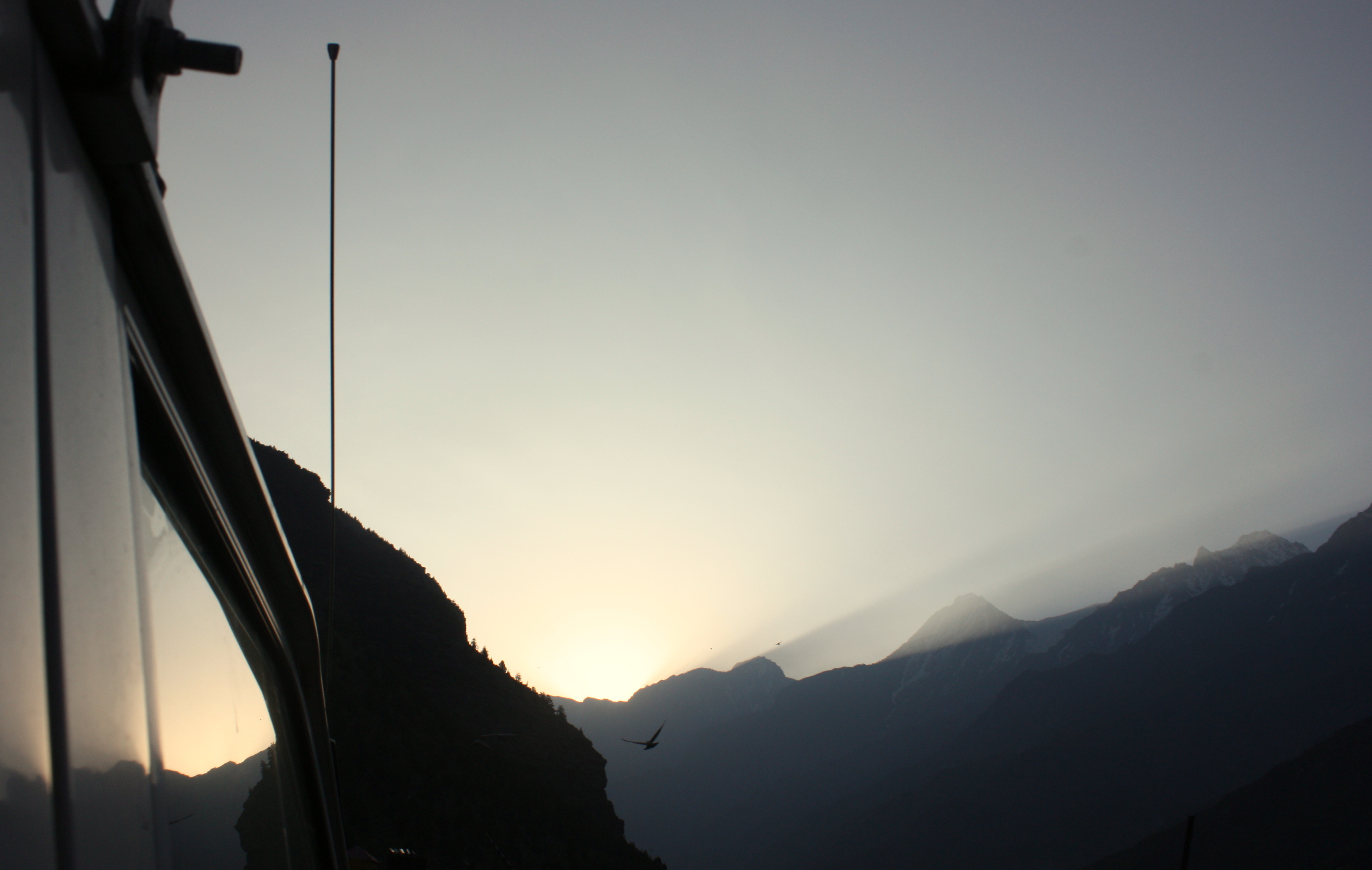
And we ended the evening with a stunning sunset.

DAY 2
Day 2 started early. I can’t remember what time we left, but I want to say it was somewhere close to 5am. Yikes. But sometimes, it’s nice to have a reason to get moving so early. I was thankful to get to see a Himalayan sunrise.
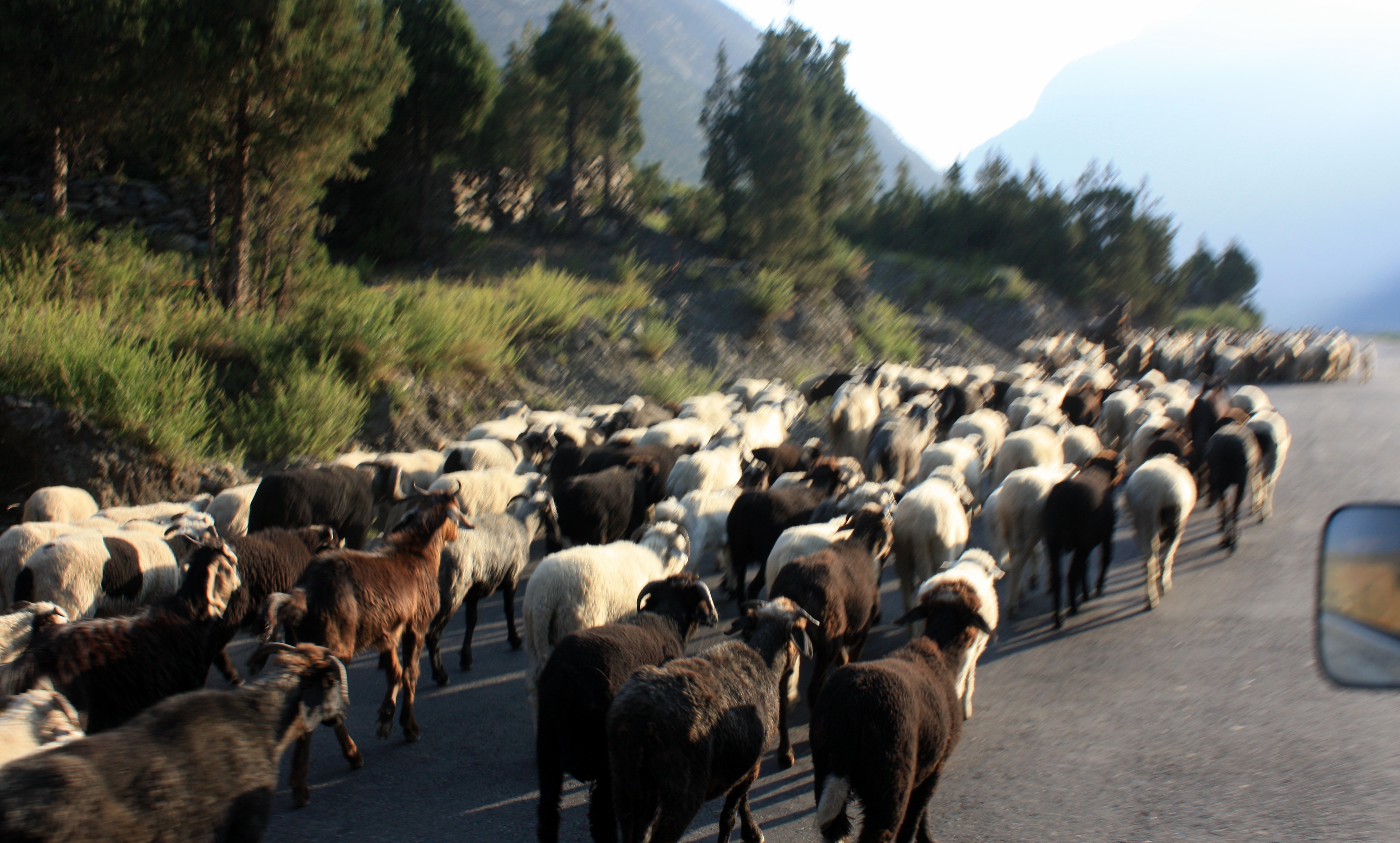
We were greeted by another herd of goats in the road as we entered Darcha for a necessary document check-point accompanied by breakfast.
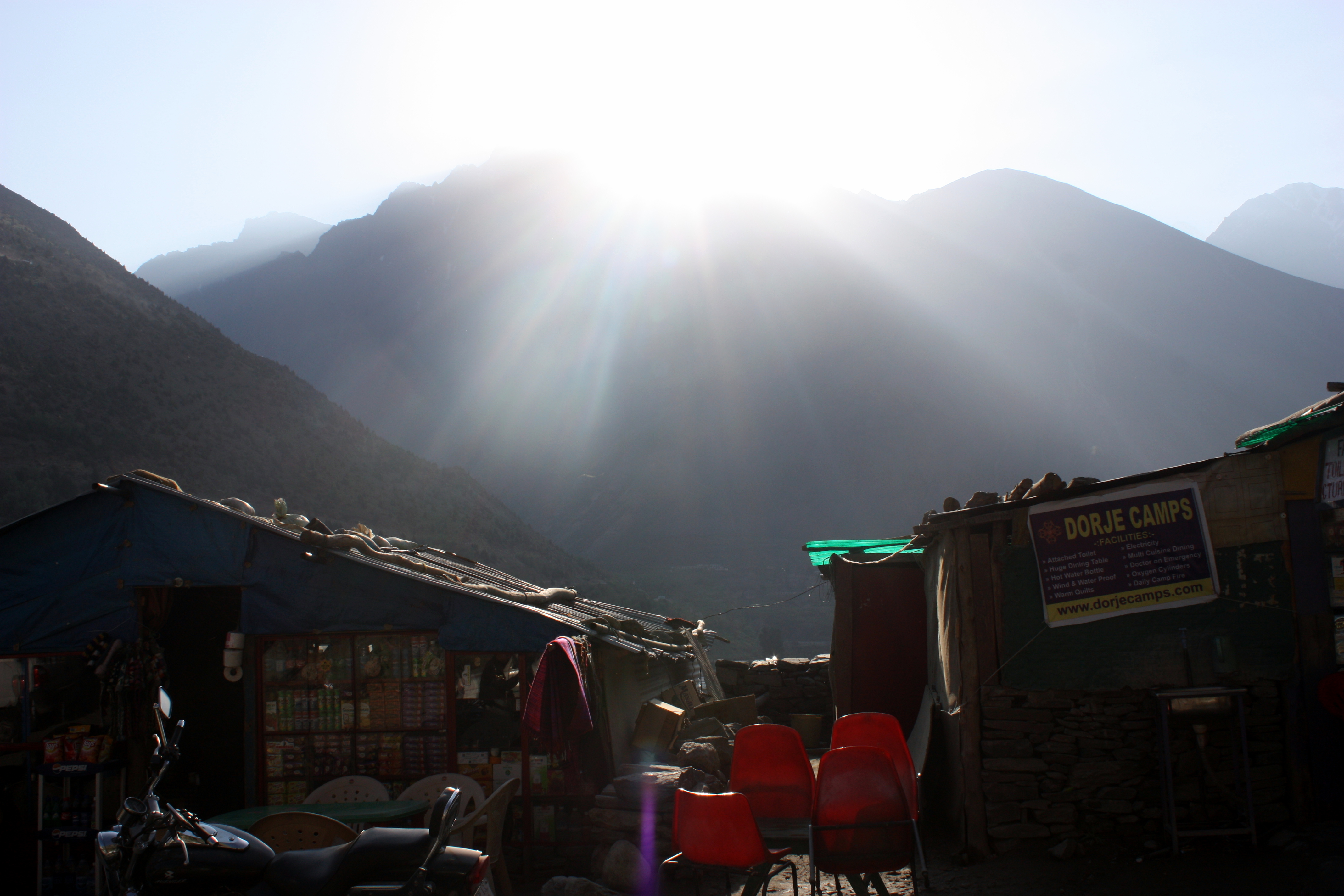
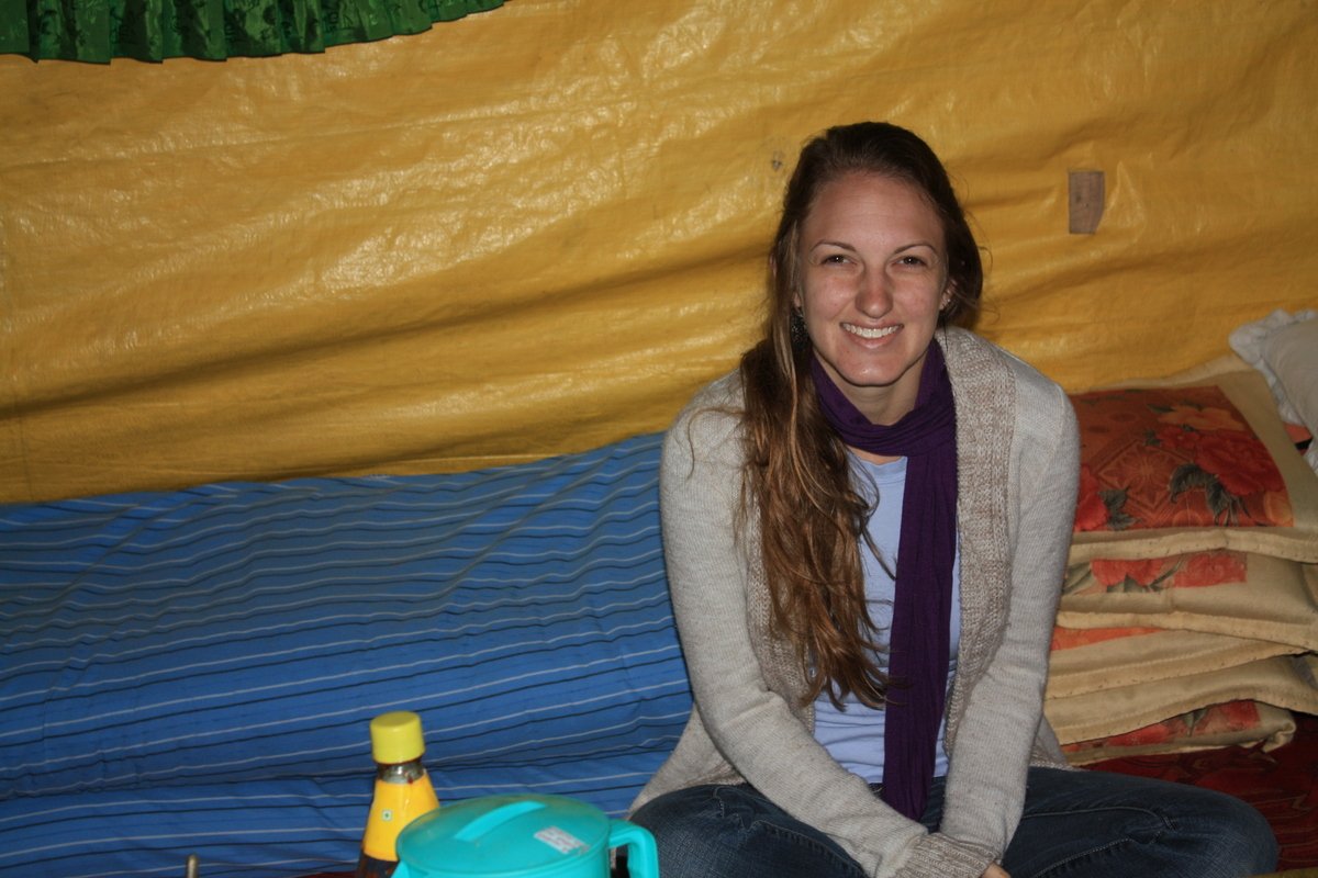
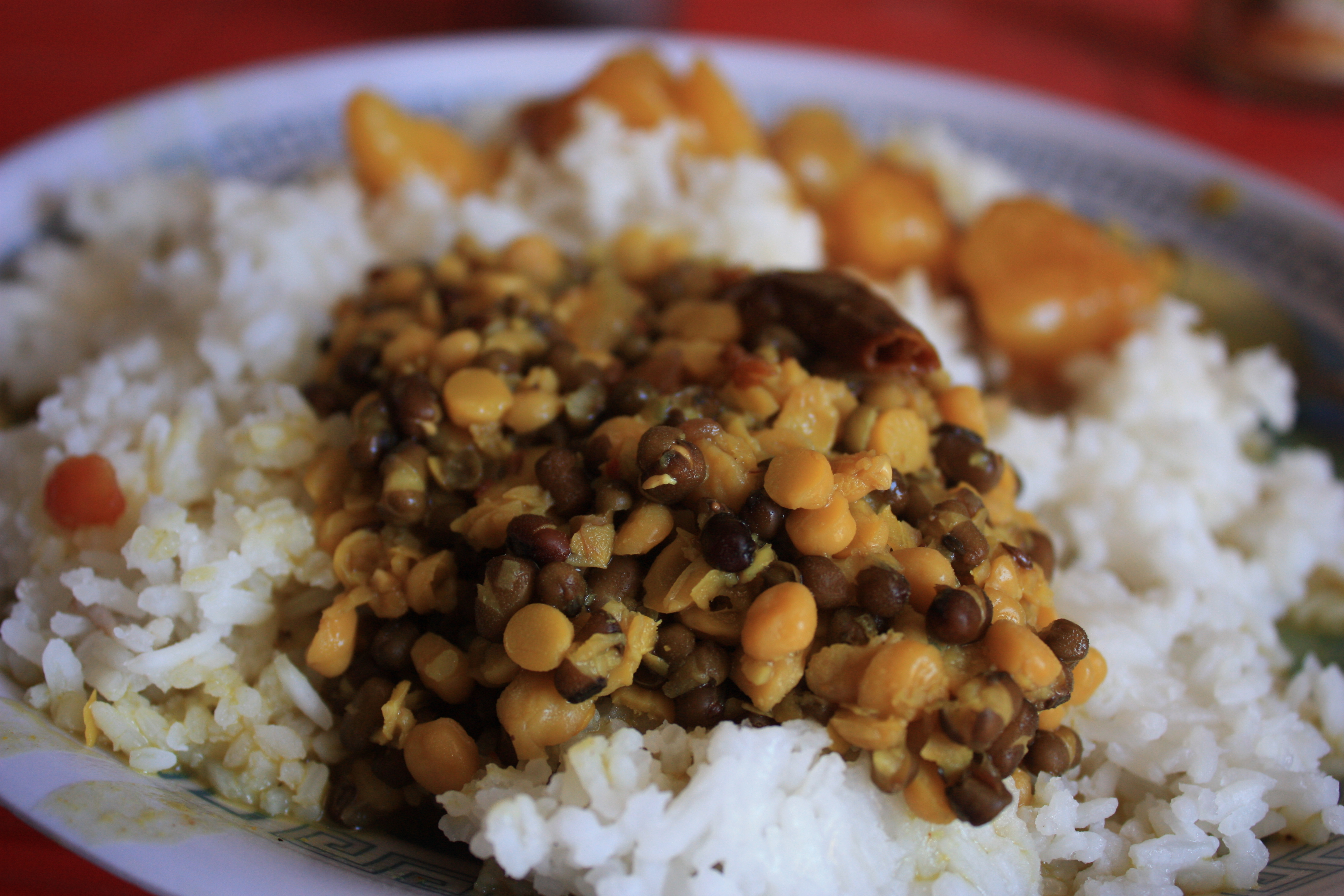
We ate breakfast inside a giant yurt-like circular tent. The edges were surrounded with layers of mats, cushions, blankets, and pillows. Tea and a yak cheese omelette. Yes please. A wonderful way to start the day. I took this picture (well, I didn’t technically take it) specifically because I wanted to have a memory of what I quickly deemed the best breakfast ever.
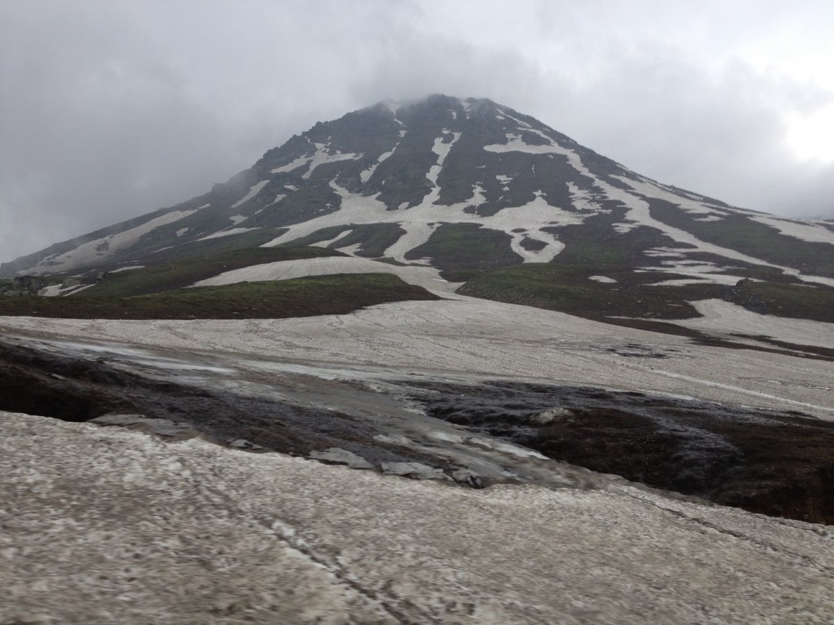
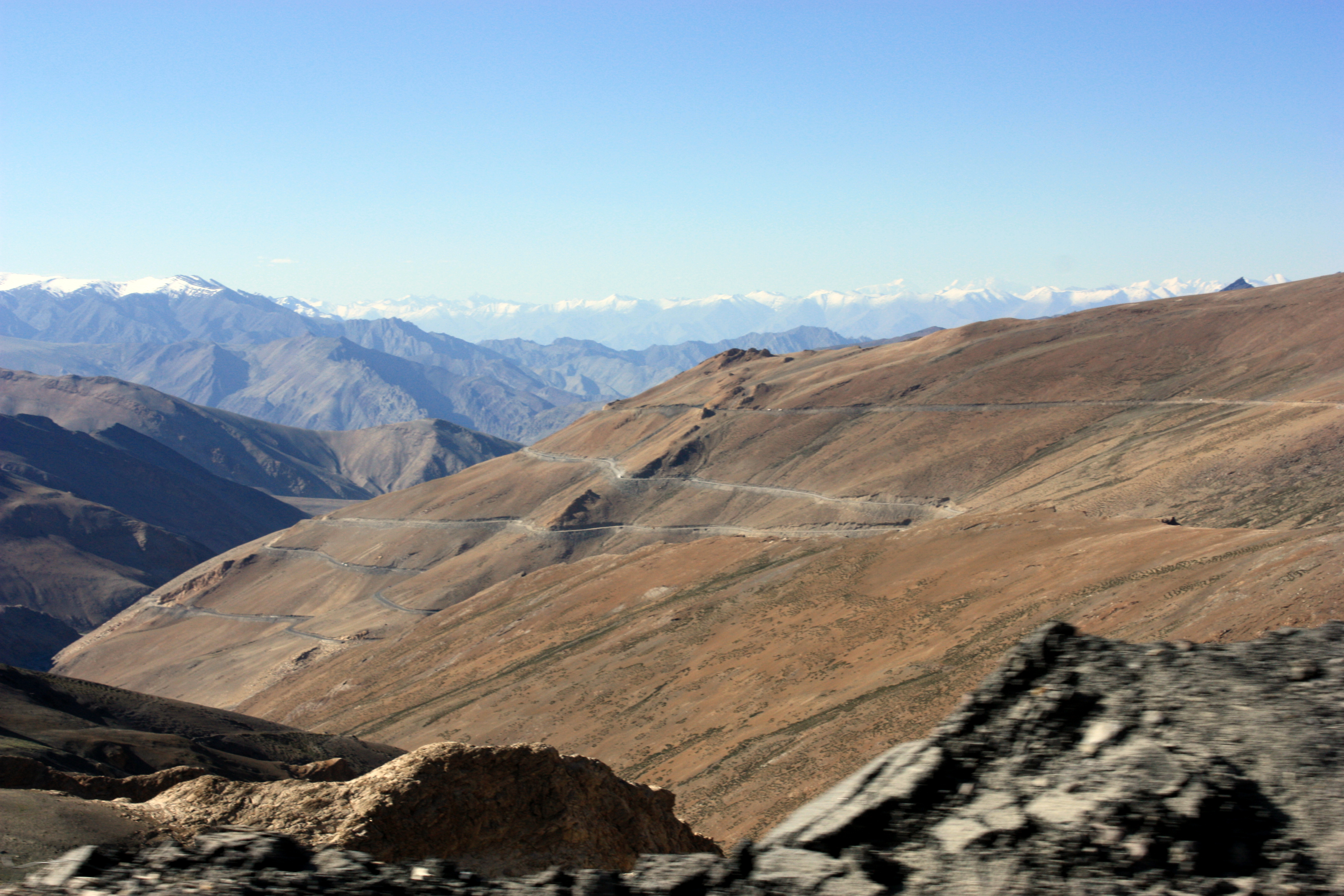
After breakfast, we started out ascent. Darcha is around 11,000 feet in altitude. Within less than 2 hours we would be up to 16,000 feet.
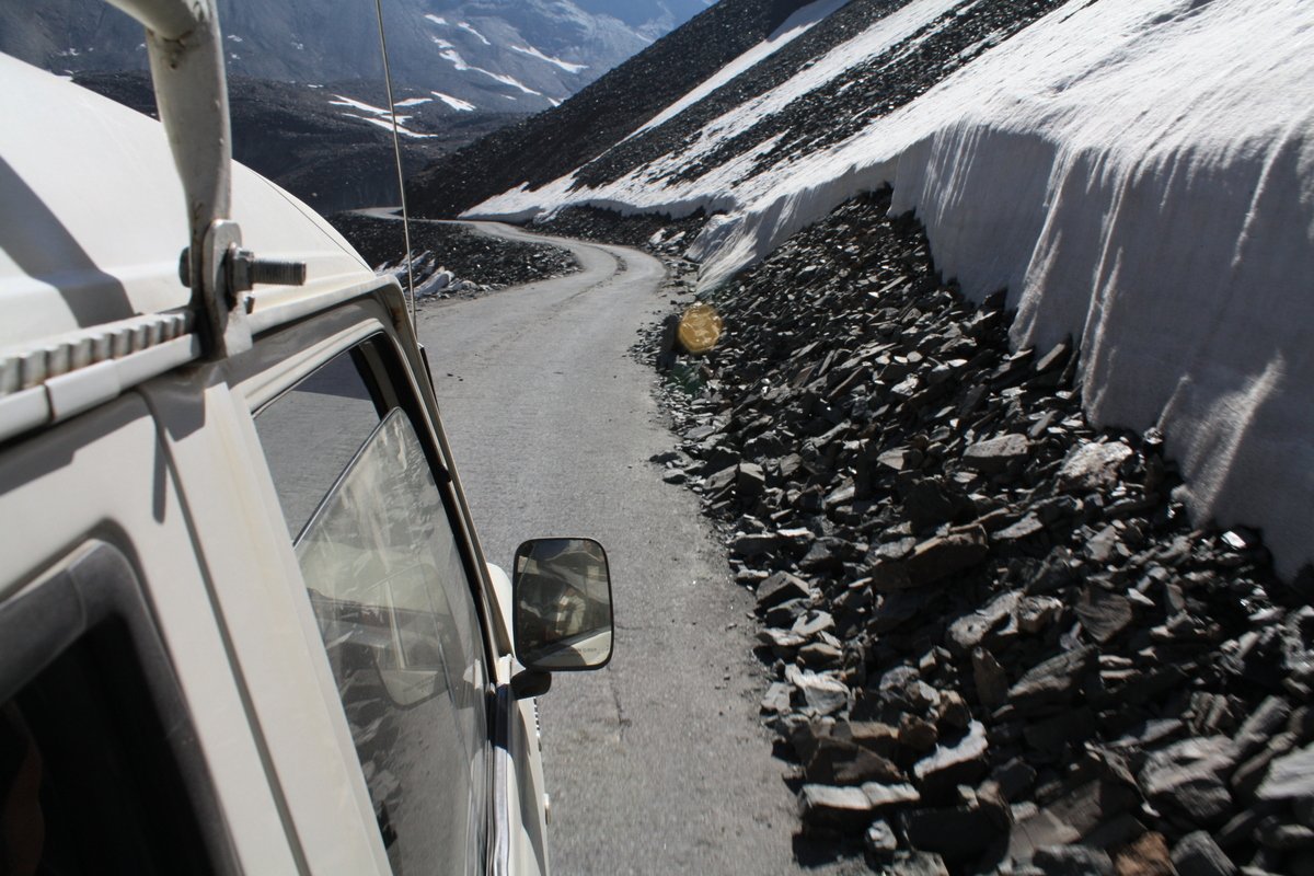
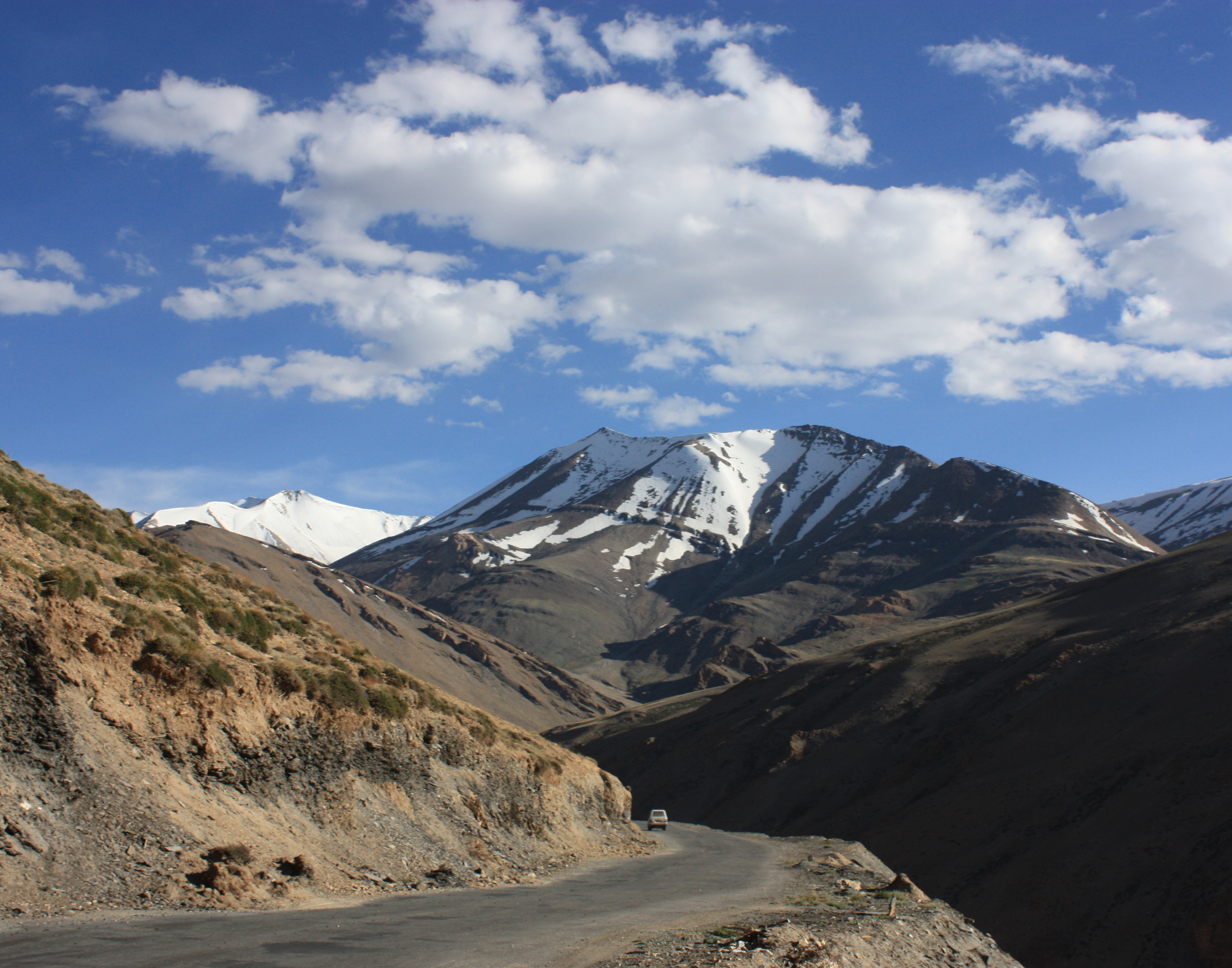
There were more and more waterfalls over our tiny hardly paved road. Most of the time we made it over without any issues, but there were multiple times I feared for my life a little.
Up, up, around, and around we went. I never would have dreamed you could gain so much altitude in so little time.
Before I knew it, we were at the top of Baralacha La Pass. 16,500 feet. Wow. I had been drinking loads of water to keep hydrated for the altitude, so I thought this would be a great photo op plus a bathroom break, (oh, ya, so in India, pulling over for a bathroom break on the side of the road is basically your only option in some places). All in one.
It was so incredible. I was giddy with excitement. I jumped out of the car, used the bathroom as fast as possible, and then popped back up to run over to look at the view from the edge of the road.
Except that no one is doing any running at 16,500 feet. As soon as I stood back up, immediately my head started spinning. Dizzy. Not. Enough. Oxygen. Instead of breathing deeply, I did the opposite and just freaked out. I got back in the car as fast as I could. And by that time, I could feel numbness moving steadily from my fingertips to my elbows and likewise from my toes to my knees. It was so crazy.
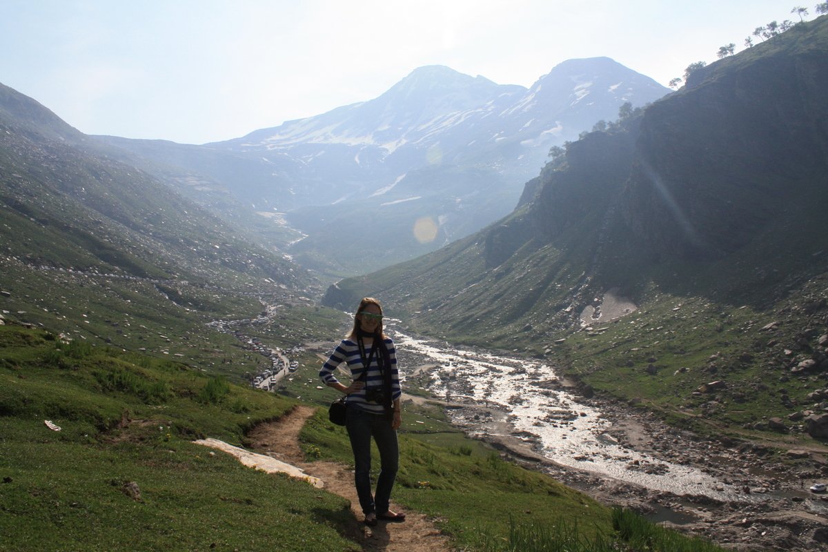
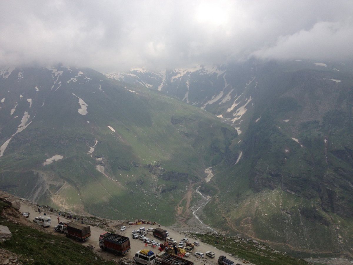
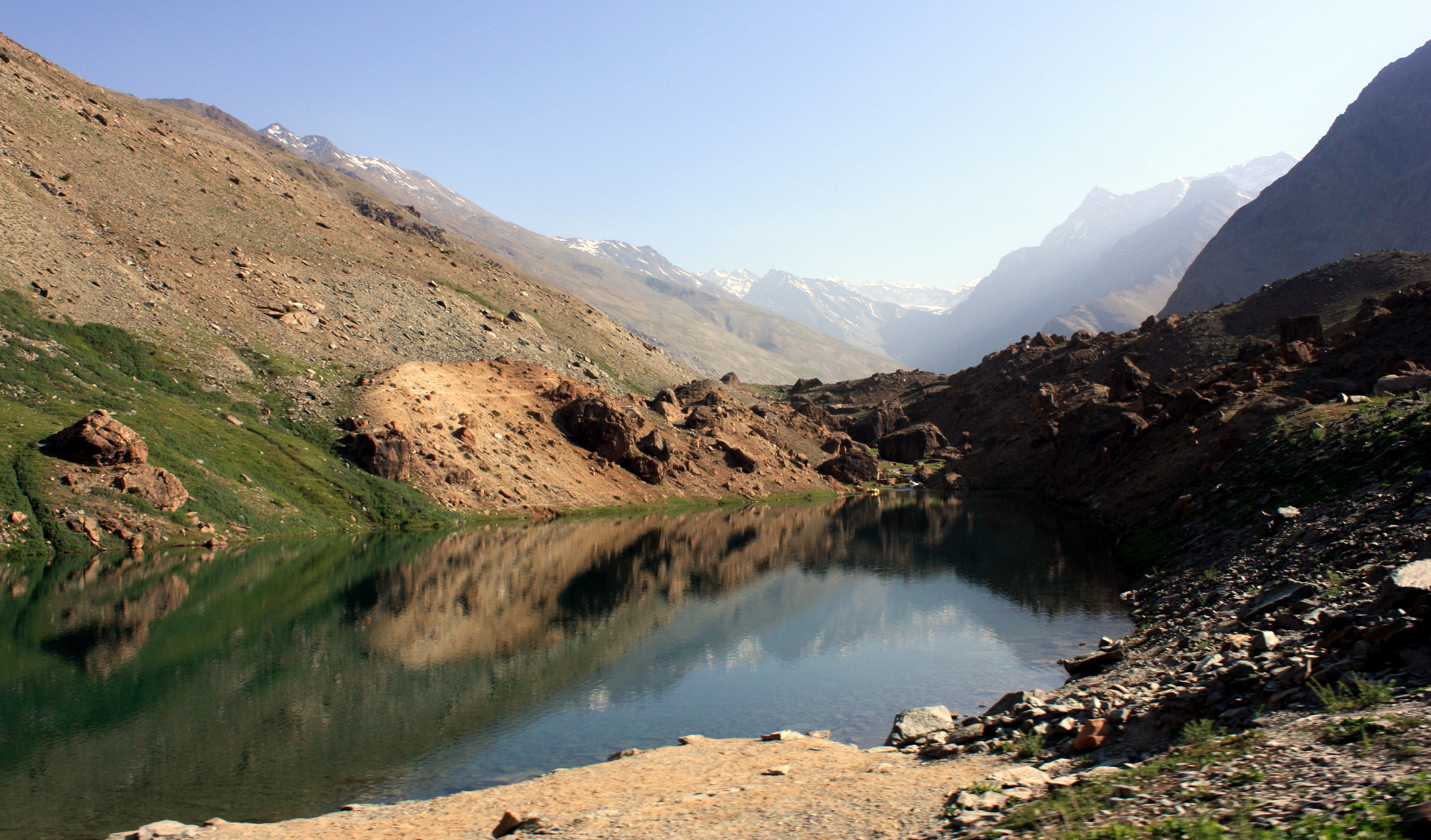
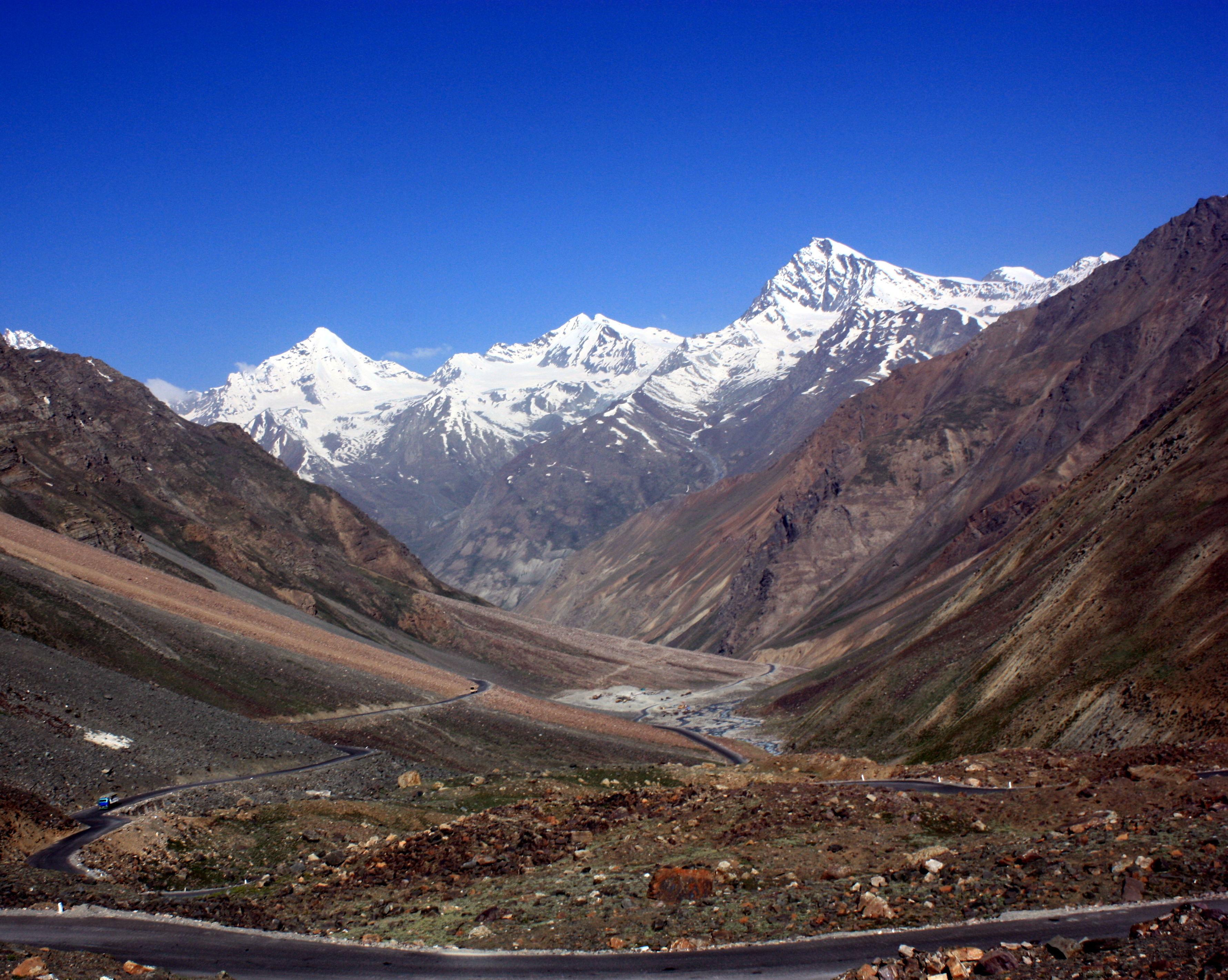
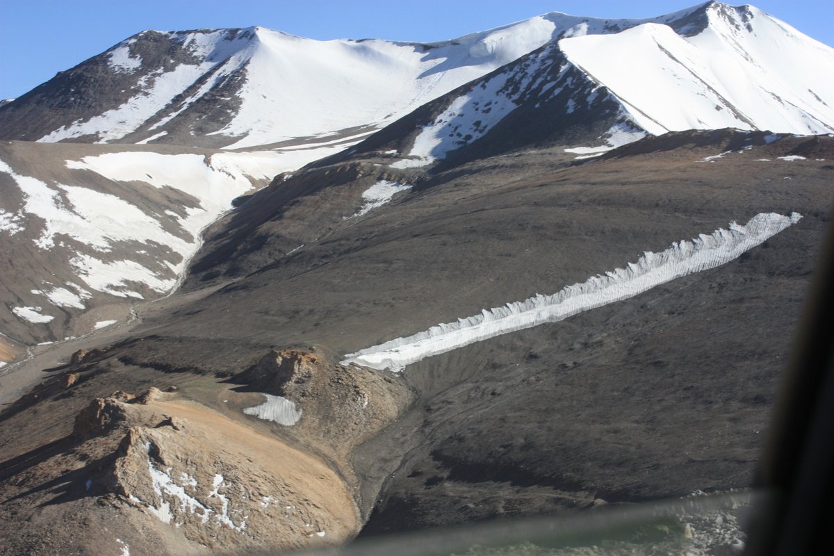
Even as we descended just a bit, the views were consistently incredible.
As we neared Sarchu (14,000 feet), we also neared end of the Himachal Pradesh and the start of the Jammu and Kashmir state.
If you don’t know, Kashmir is a highly disputed region with parts claimed by both India and Pakistan… some areas even claimed by China. Jammu and Kashmir is the Indian claim.
As I understand, it is divided into 3 main regions. Ladakh in the east and Jammu and Kashmir Valley in the west (next to Pakistan). Jammu is majority Hindu; Kashmir Valley is majority Muslim; and Ladakh is about half Muslim and half Buddhist. The western regions, Jammu and Kashmir, have been plagued by violence for countless years. However, perhaps due to its relative distance from Pakistan and perhaps in part to its large population of relatively peaceful Tibetan Buddhists, Ladakh has, for the most part, remained free from violent conflict.
You can see a picture here: Jammu & Kashmir map
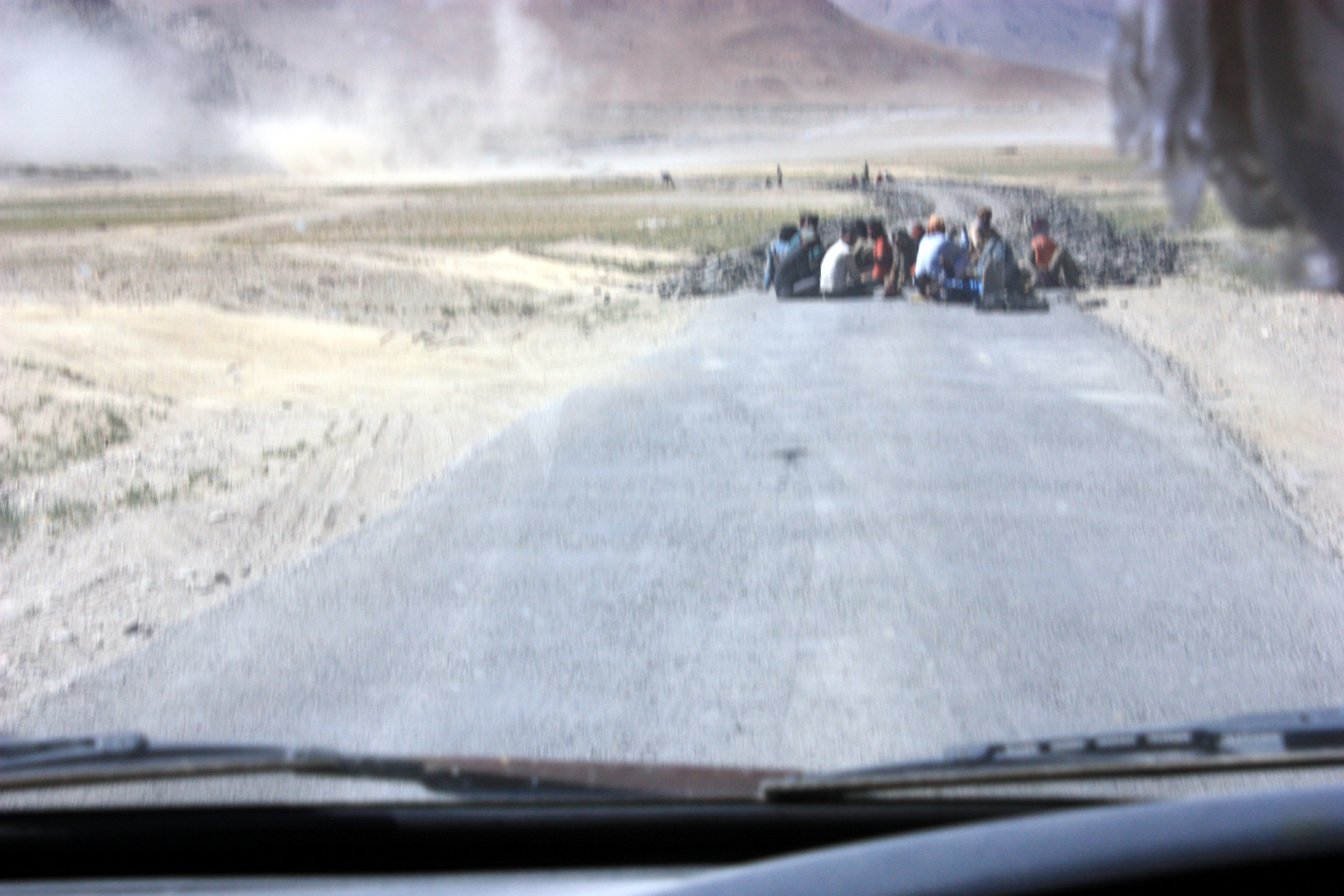
We had to go through quite a few checkpoints along the way.
After passing the necessary check points, we continued on a few more miles to eat lunch in Sarchu…
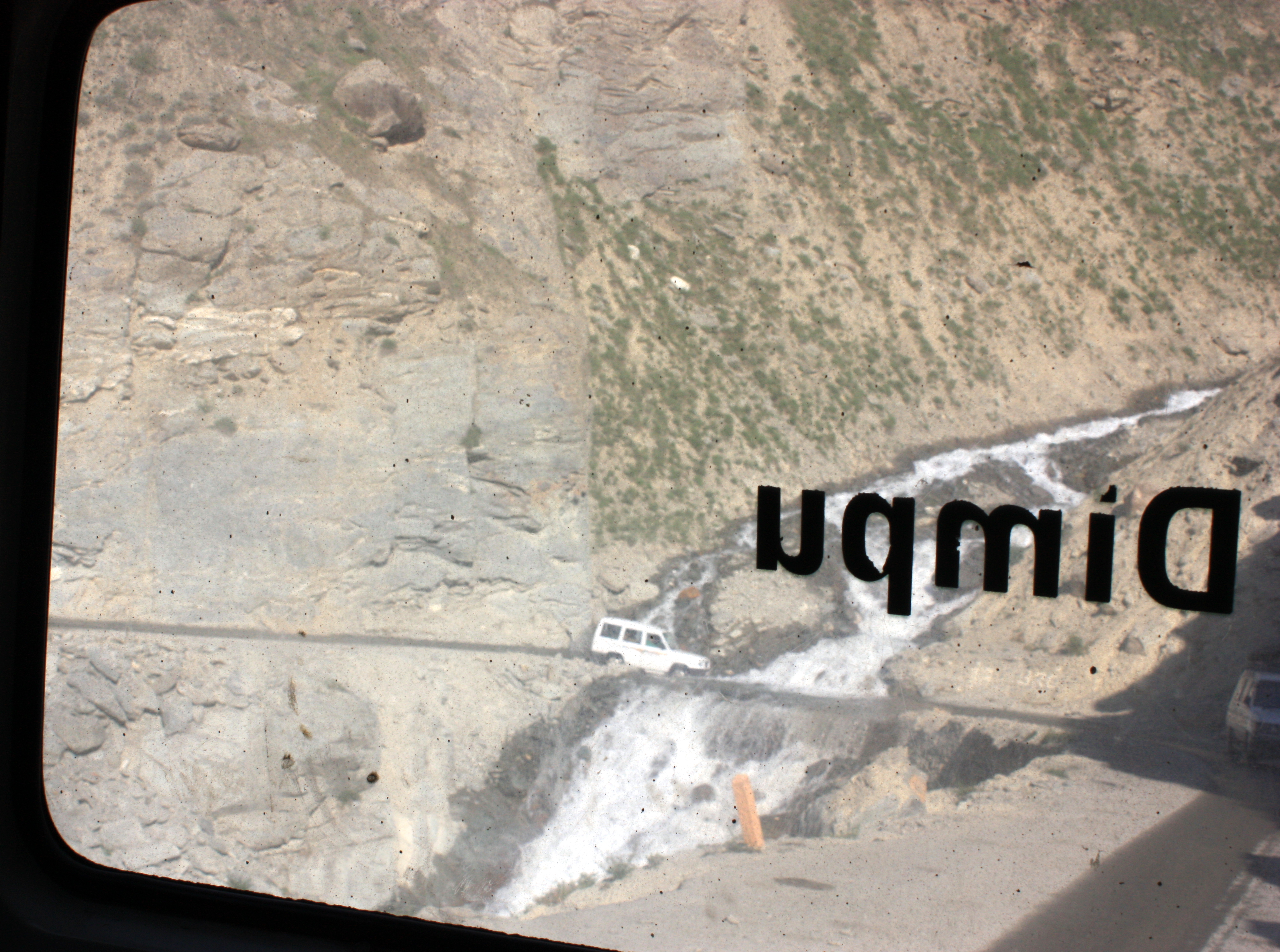
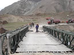
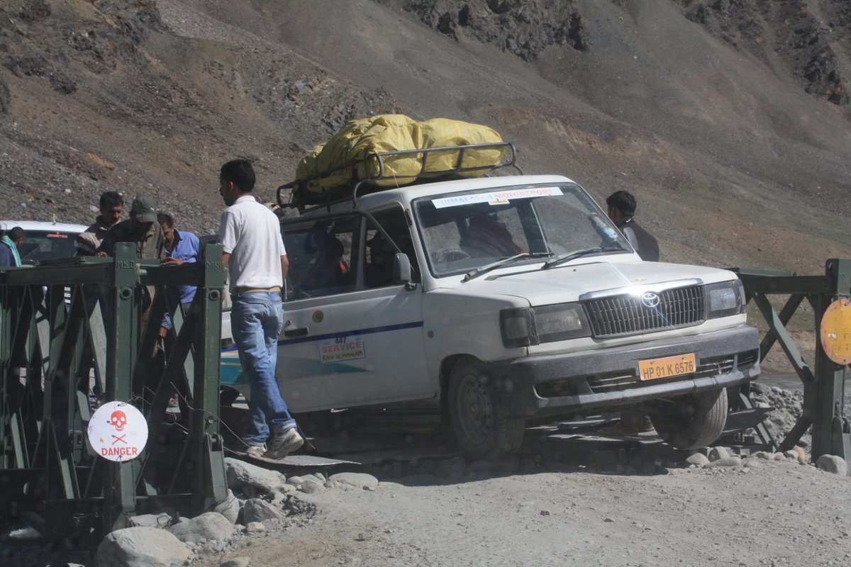
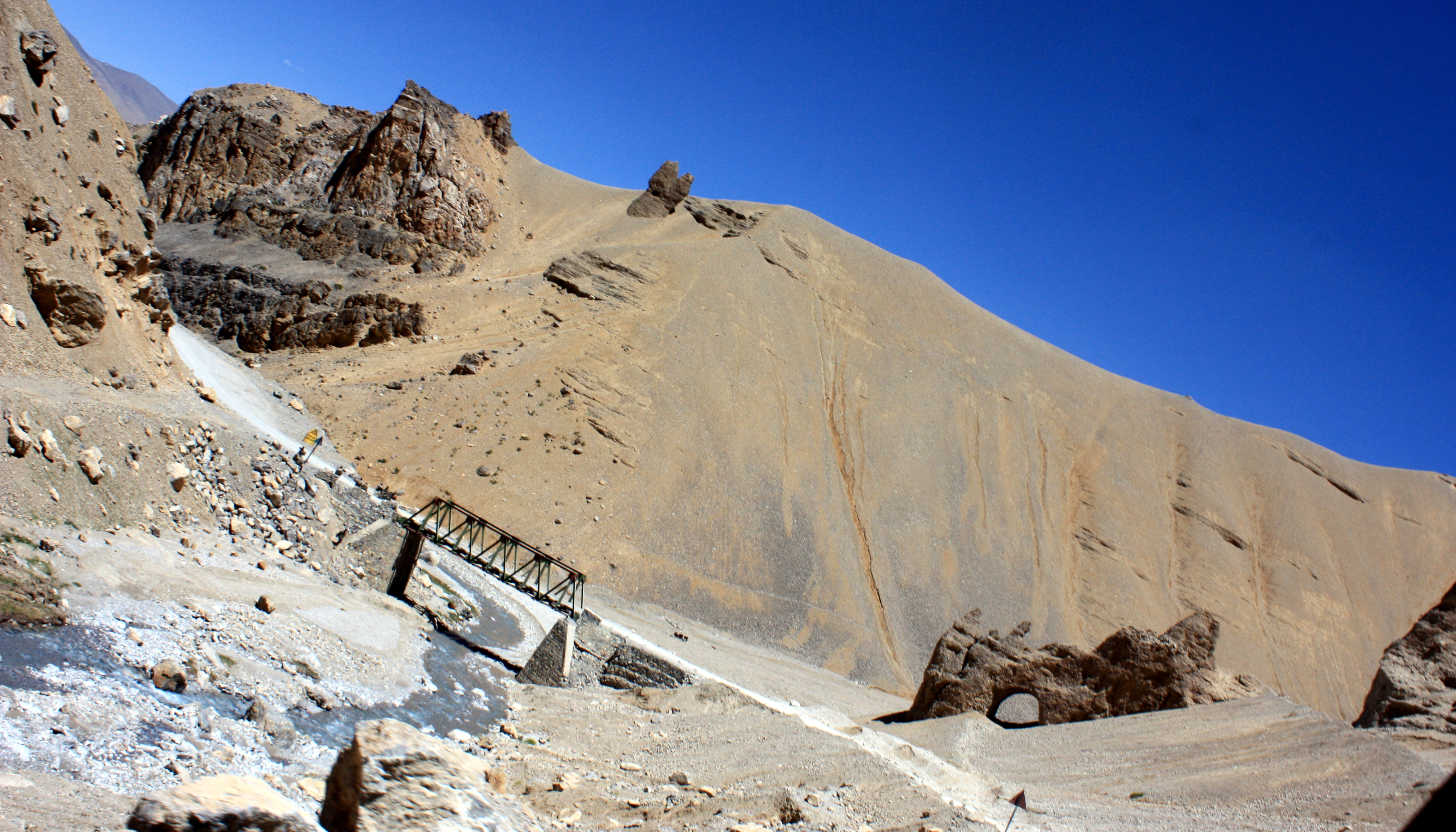
Now, aside from the dangerous roads with waterfalls, avalanches, and unexpected curves and dropoffs, we also crossed a good number of perilous bridges.
I didn’t take a good picture, but to give you an idea, here is one I found online of one of the bridges we would have crossed.
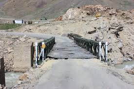
In fact, one of those may be the exact bridge. I can’t explain it to you, but hopefully, you’ll feel with me that this bridge may not be exactly sound.
Every time we went over one, I held my breath. I saw those wooden or metal bars moving further apart as our car crossed and the tire put more weight on the bars. On one particular bridge, I noticed before we crossed that some of the flat covering sheets of metal were missing and the metal bars under the flat sheets seemed abnormally far apart, so much so that I wondered if our tire could slip through. We had a close call at the very end, but made it off the bridge just in time.
The car after us wasn’t so lucky.
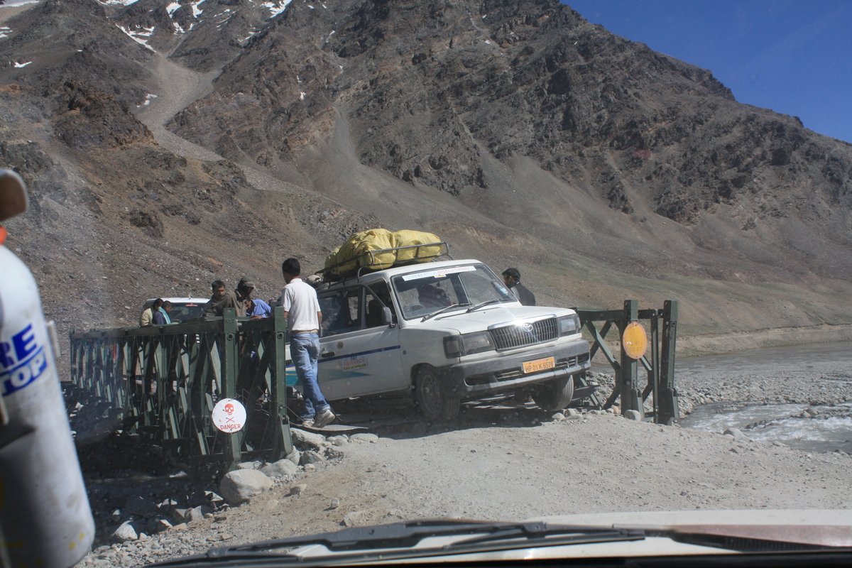
Their back tire fell through one of the gaps. Luckily it wasn’t a raging river below. And luckily they didn’t fall all the way through. And luckily, Indians are a thousand times more easy going than Americans generally are. It didn’t seem to phase any of them. They laughed a bit and got to work problem solving. Indians are also great at creative problem solving in real-life situations. I may have totally made this detail up, but I am fairly certain our driver got out to see if they needed any help.
Finally, we stopped for a great lunch in sarchu. I hadn’t been feeling great ever since the altitude hit me all at once at the top of Baralacha La. But even the little bit of lunch I ate seemed to do me good. (In retrospect, it’s so obvious that I badly needed food … anyone who knows me knows that a little food goes a long way in increasing my physical, mental, spiritual well-being).
And then, we were on the road again.
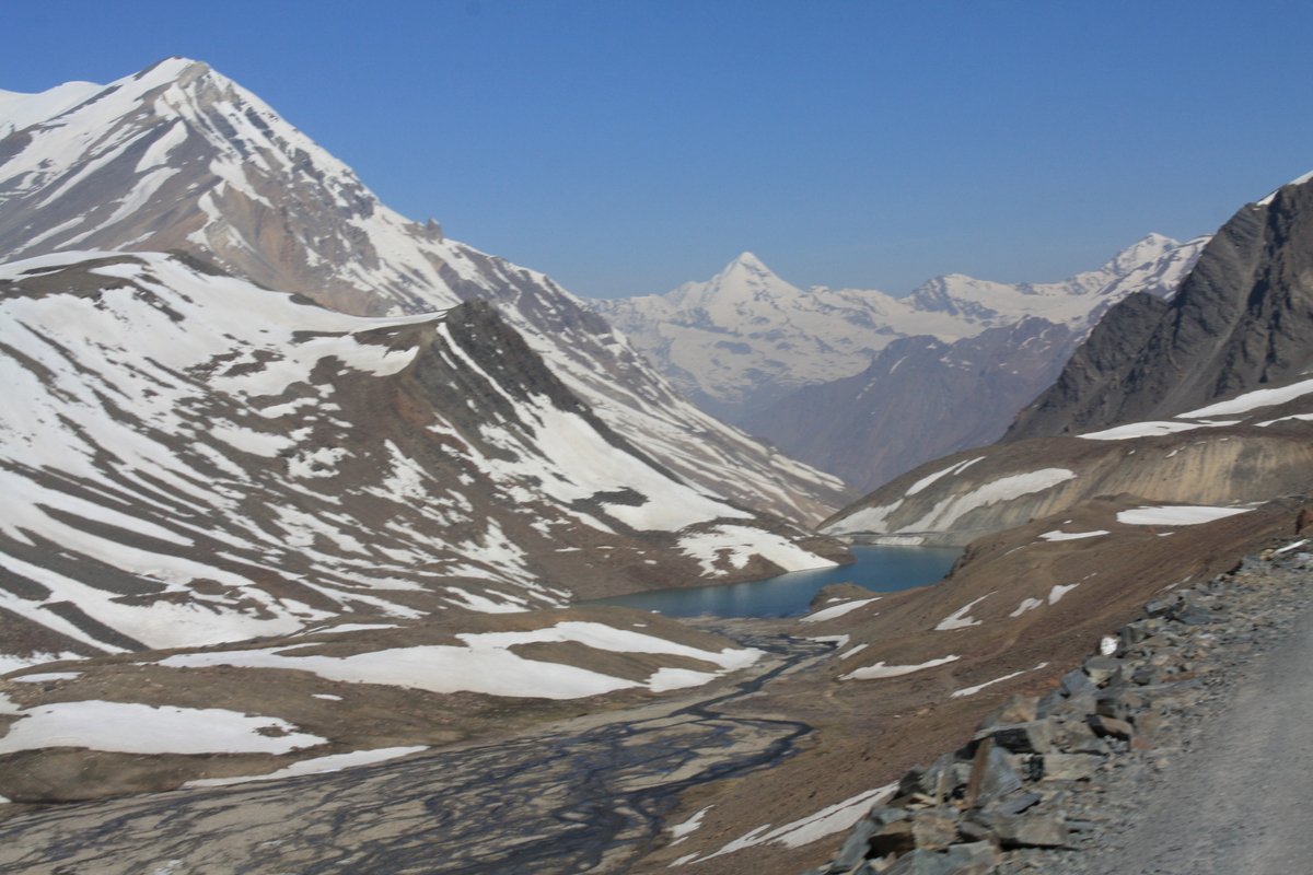
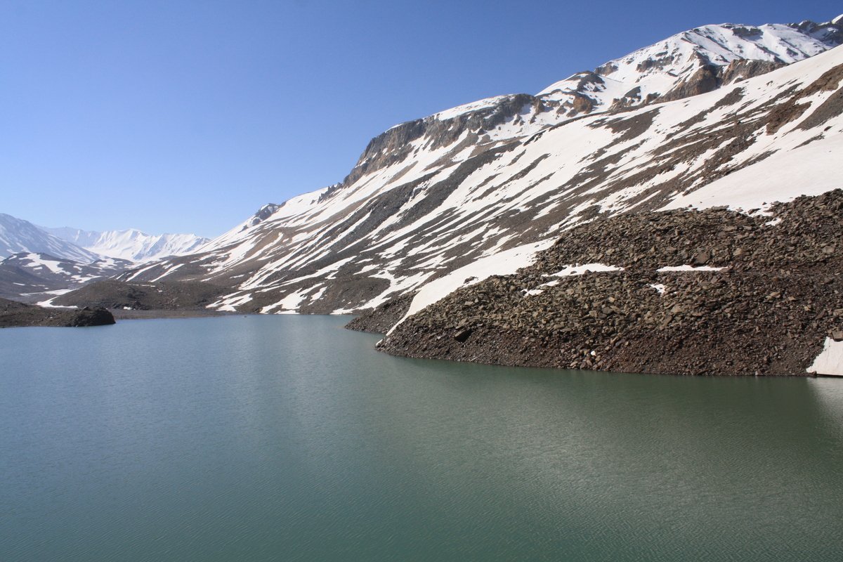
And as we drove (up again), the scenery began to change again.
Within an hour, we were back to a pretty constant 15,000-16,000 feet, winding around as usual.
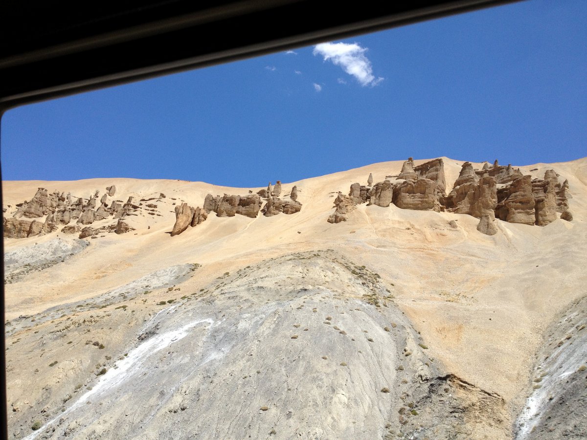
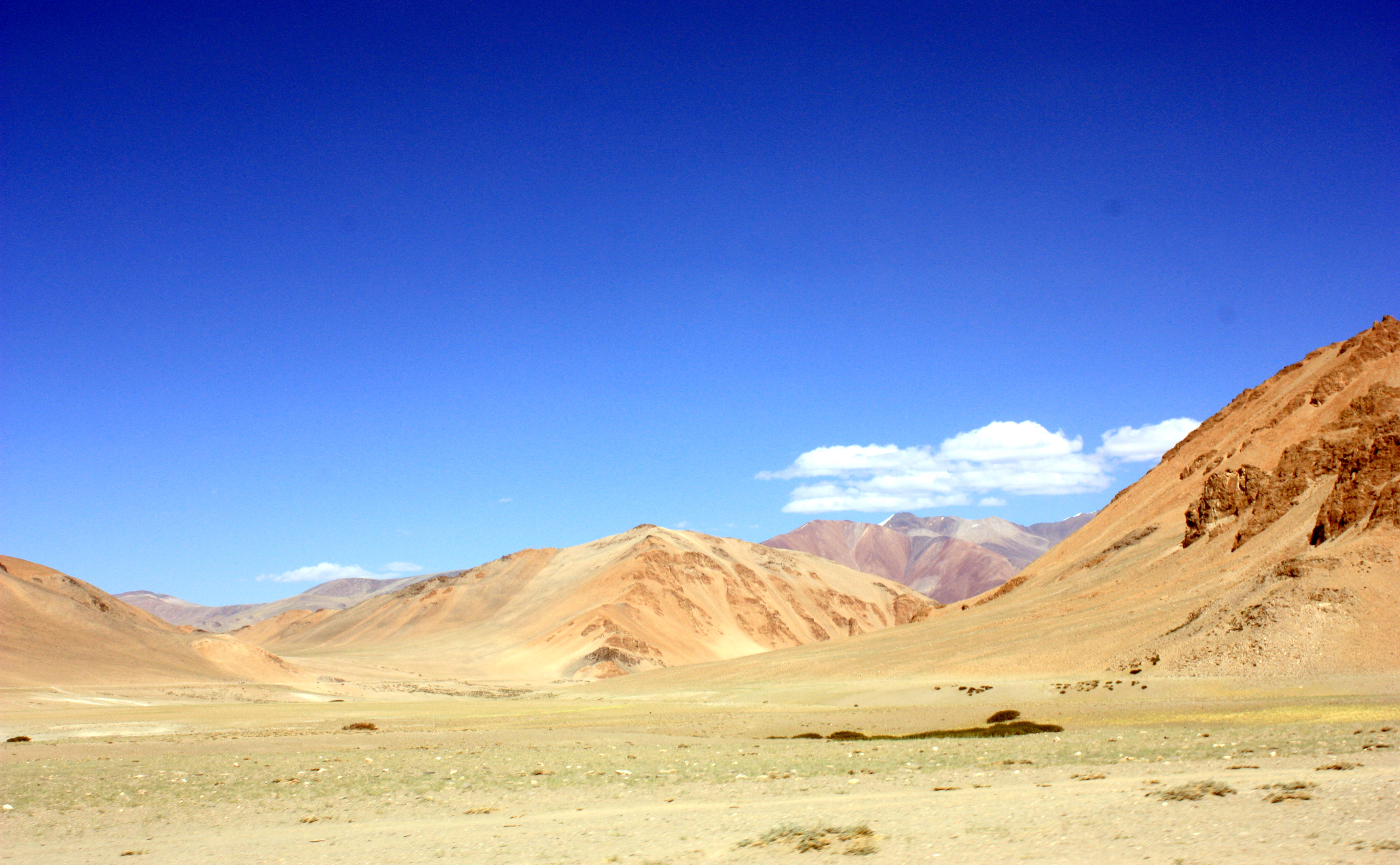
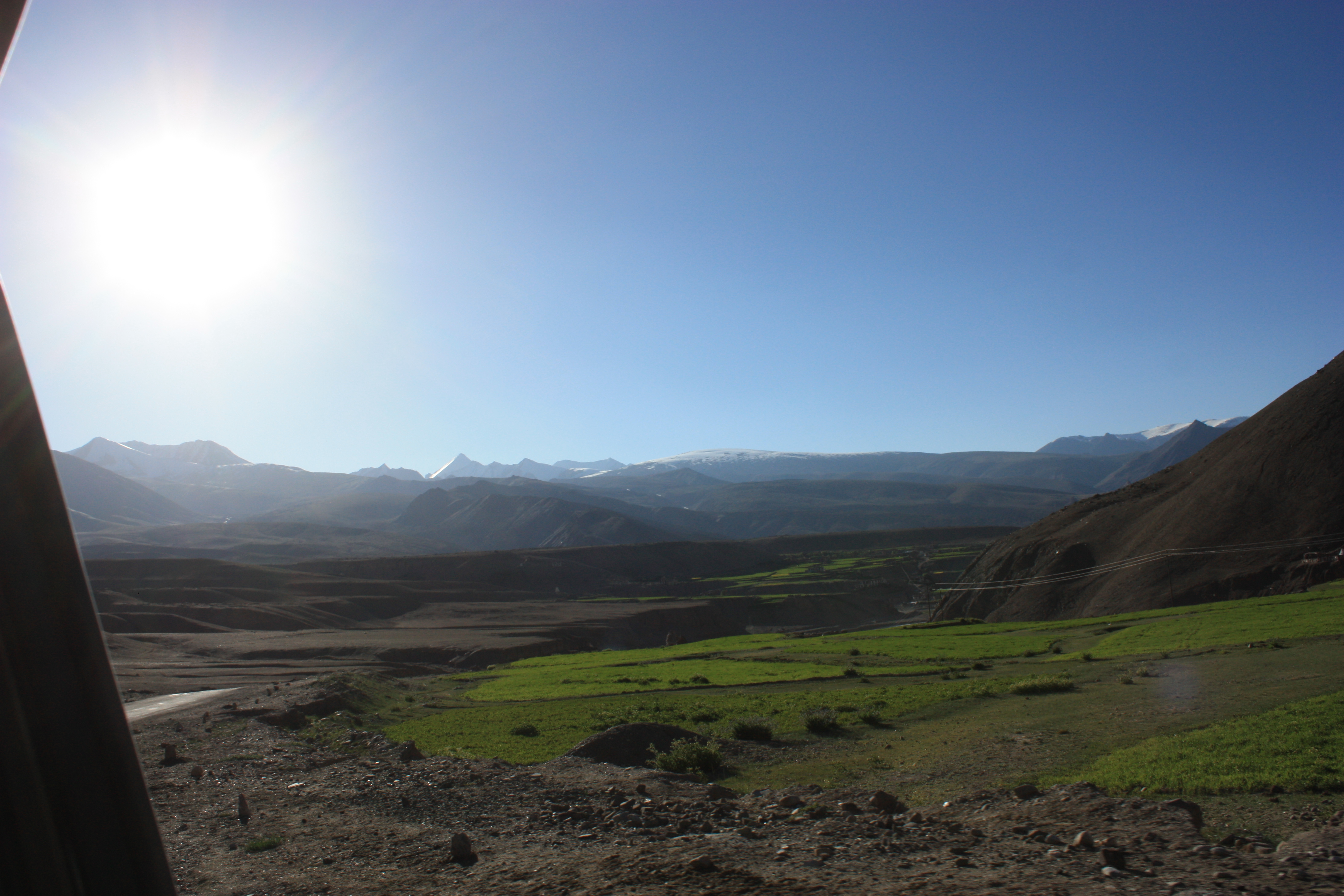
And then, we turned a corner, and all of a sudden, we were in a desert… At 15,000 feet. I was shocked. I didn’t know that could happen.
It wasn’t at all what I expected any part of the Himalayas to look like.
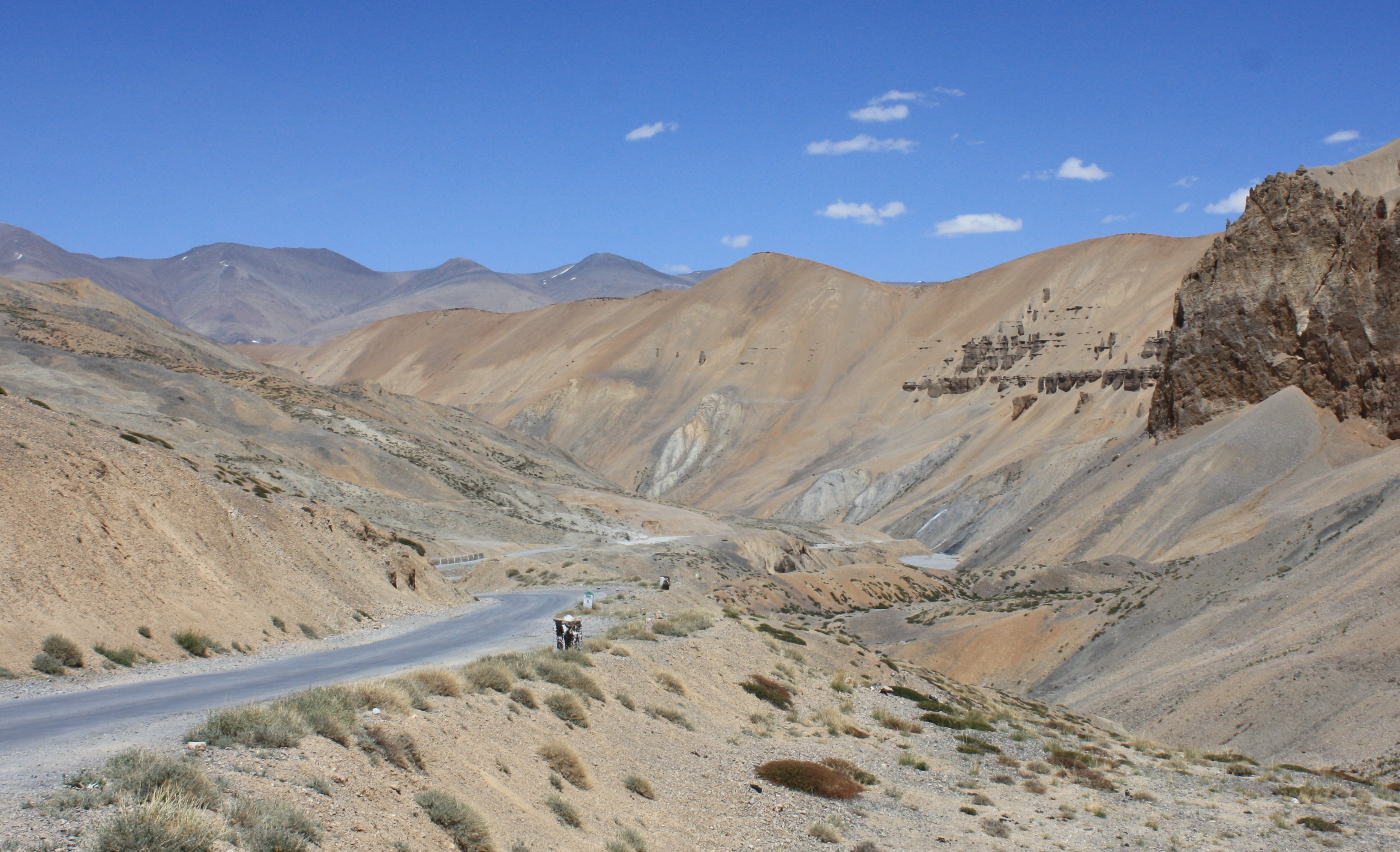
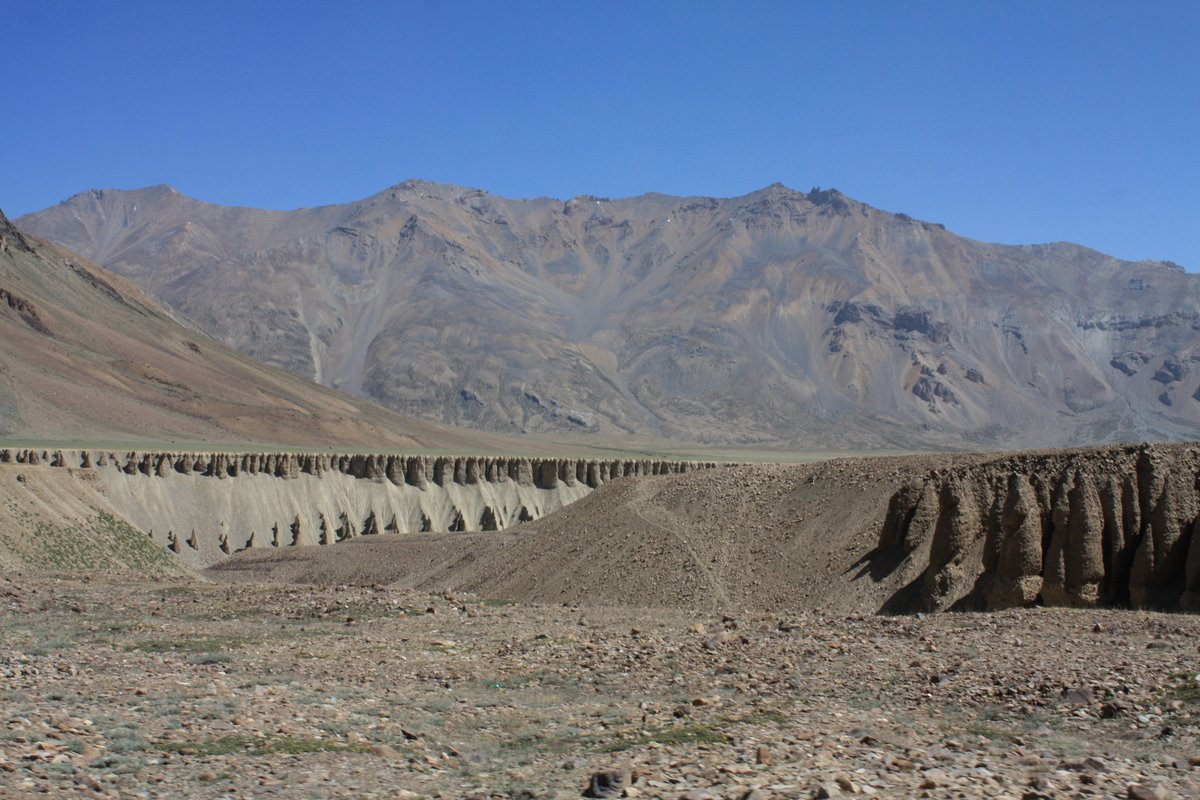
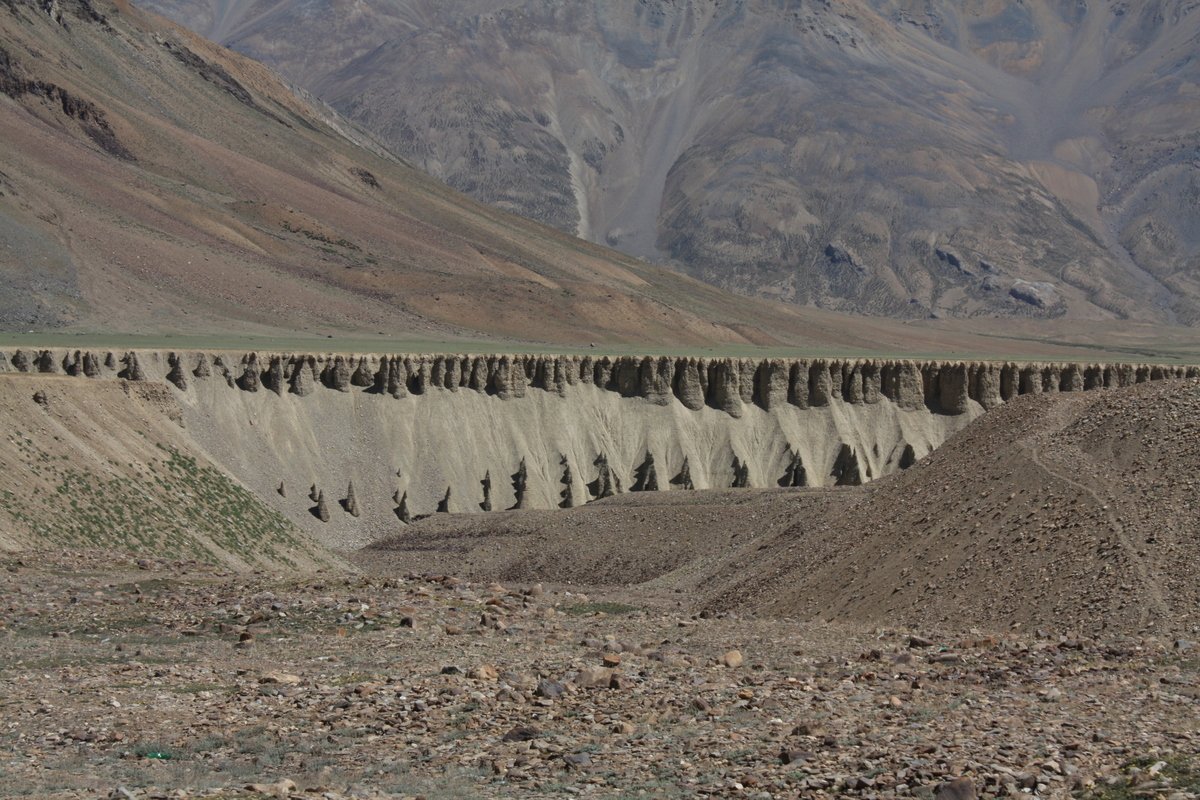
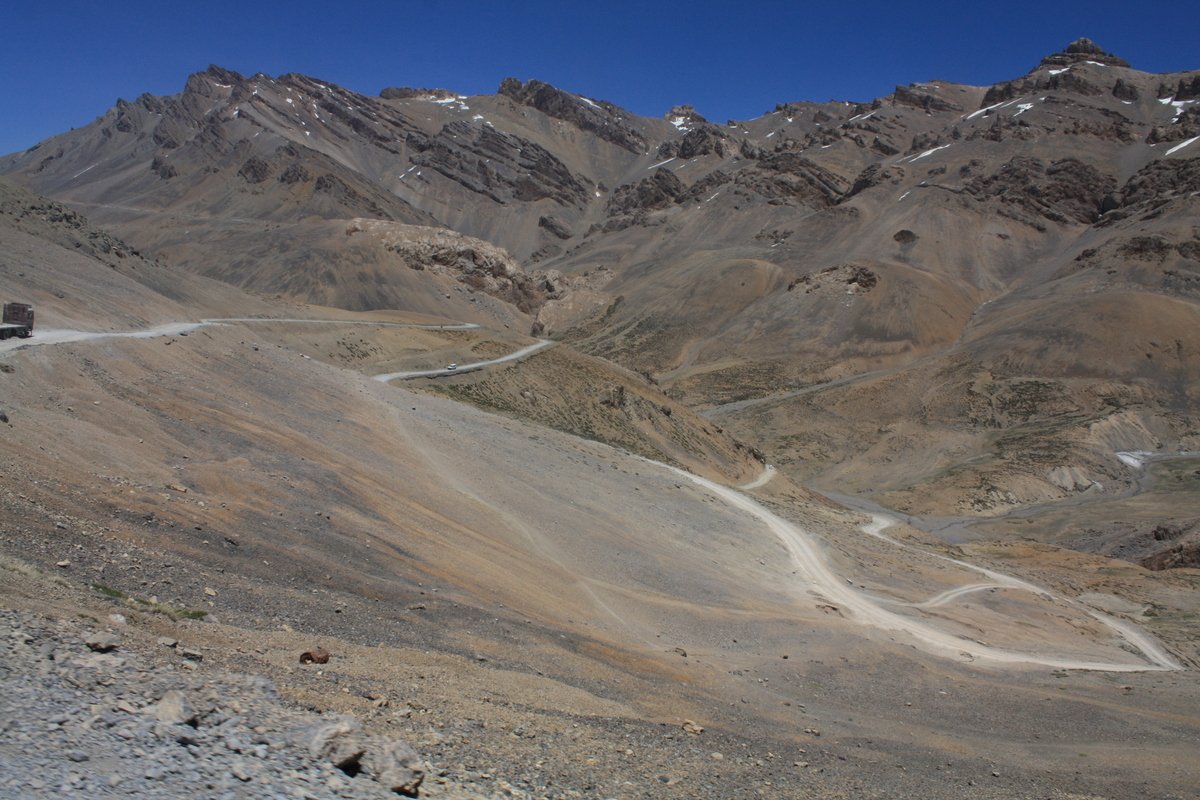
And from time to time, we’d turn another bend and reach another rocky patch.
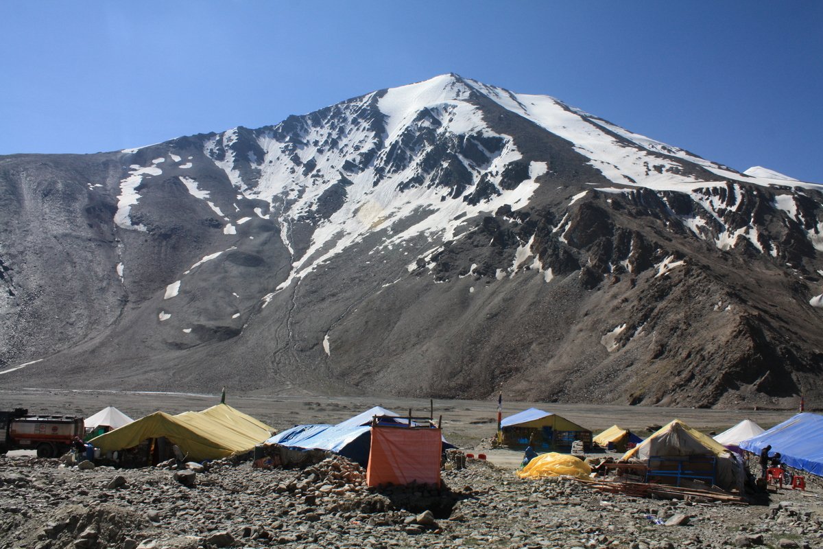
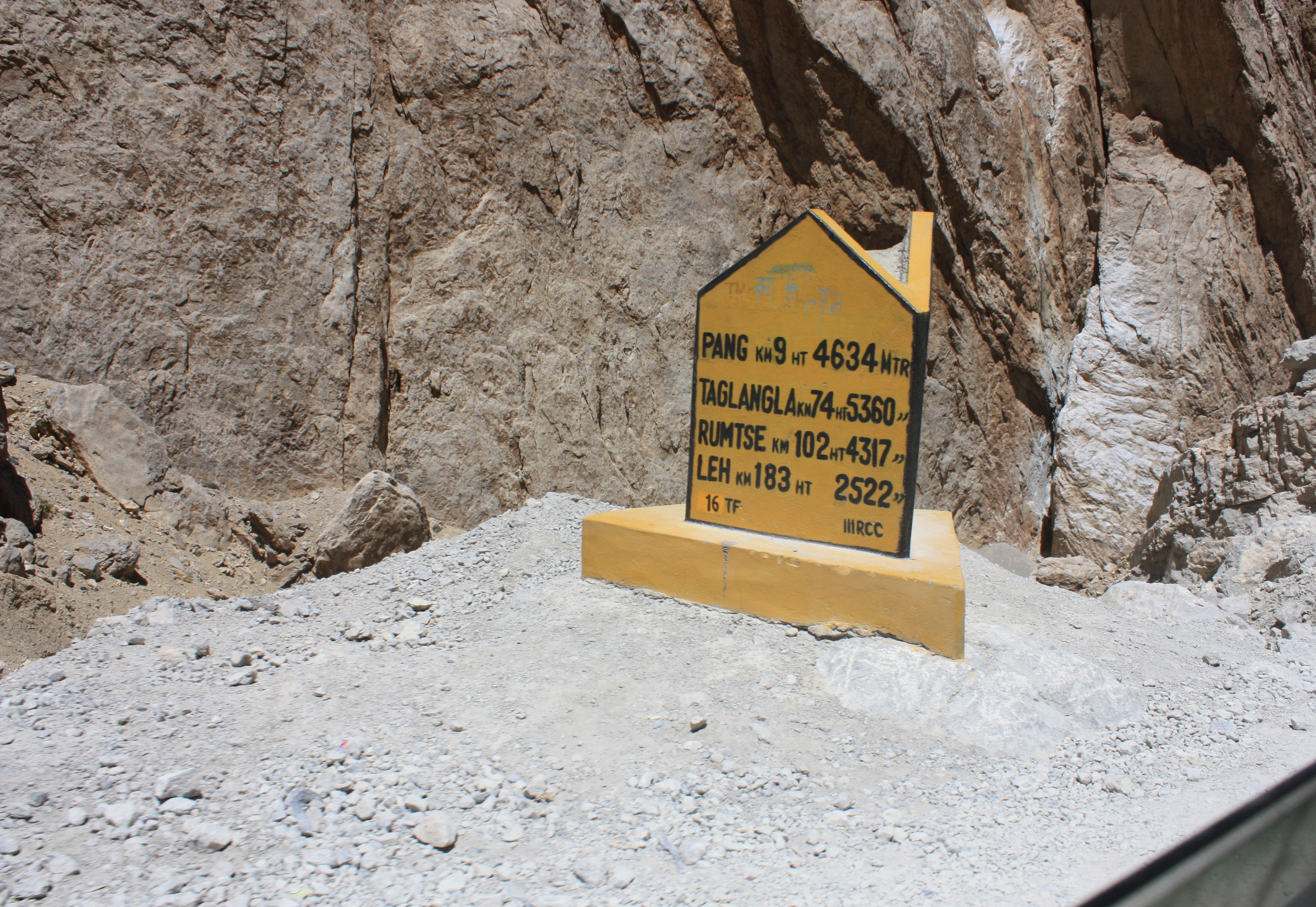
We stopped for tea in a tent camp in Pang (15,100 feet).
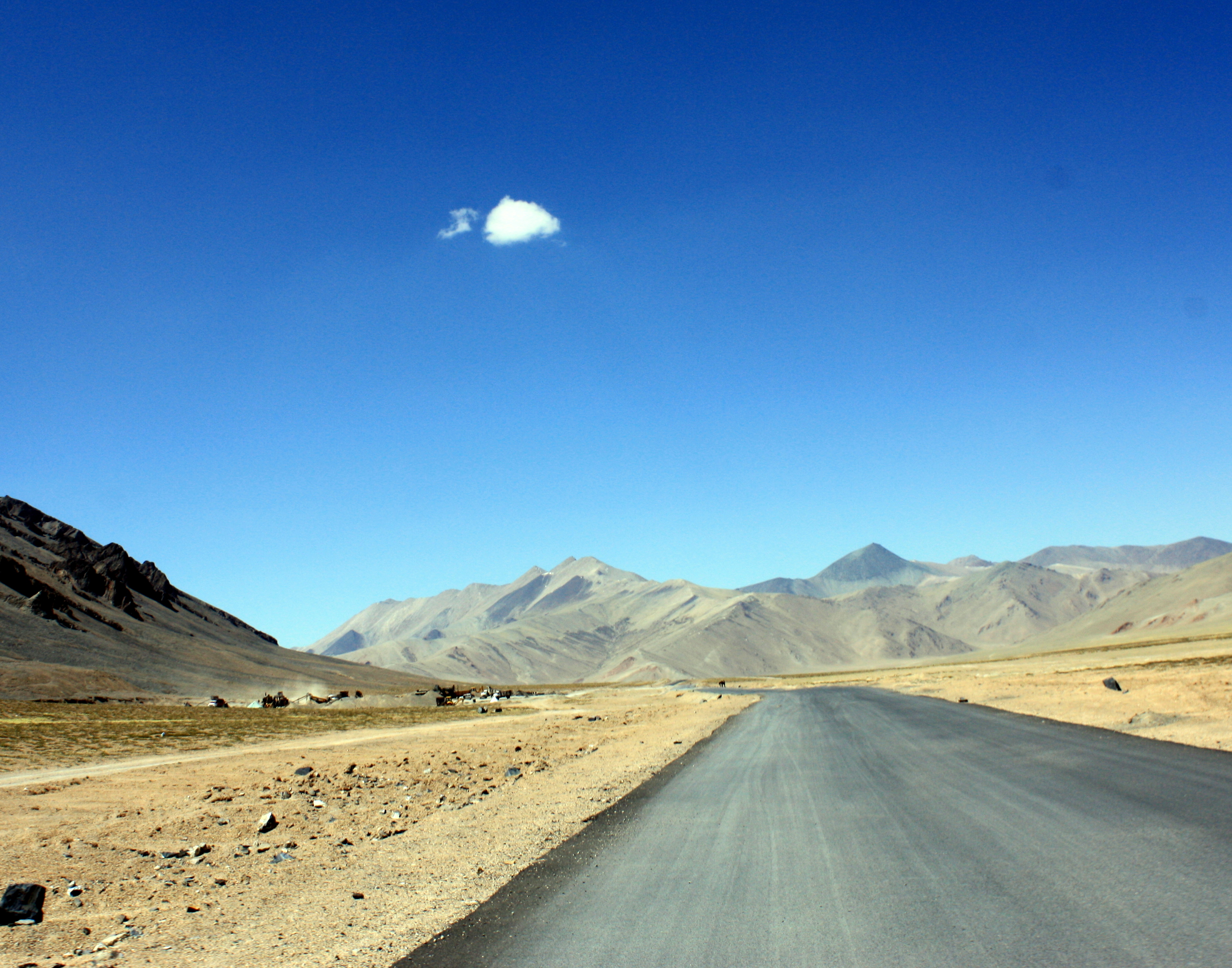
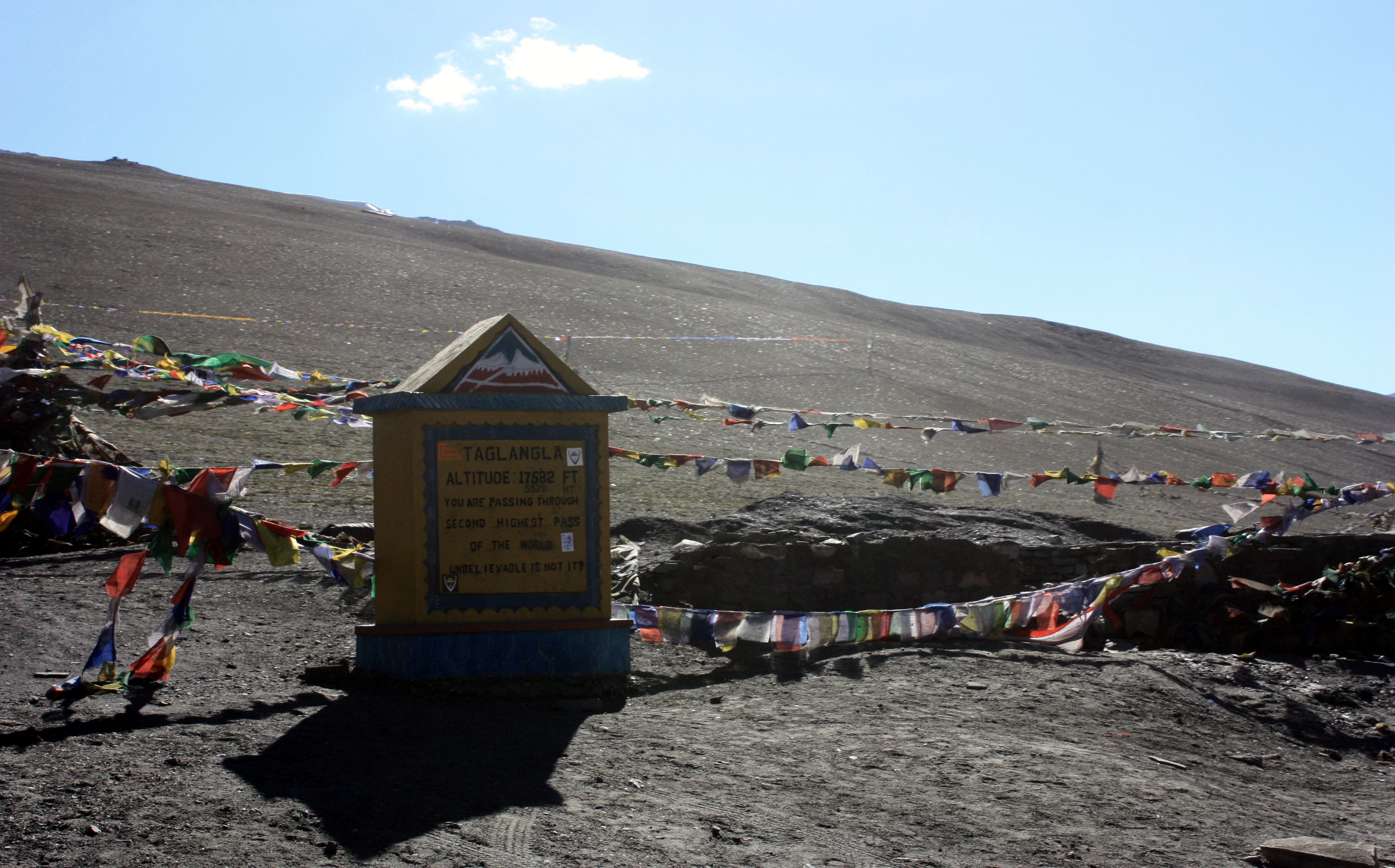
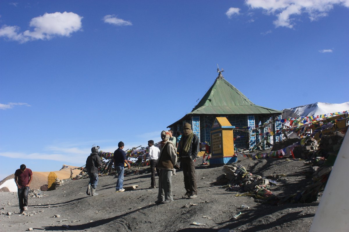
Our next stop would be Tanglang La Pass at around 17,500 feet. Claiming to be the 2nd highest drivable mountain pass in the world.
So, we were on the road once again. Smooth sailing? Hahaha. Think again. This is India.
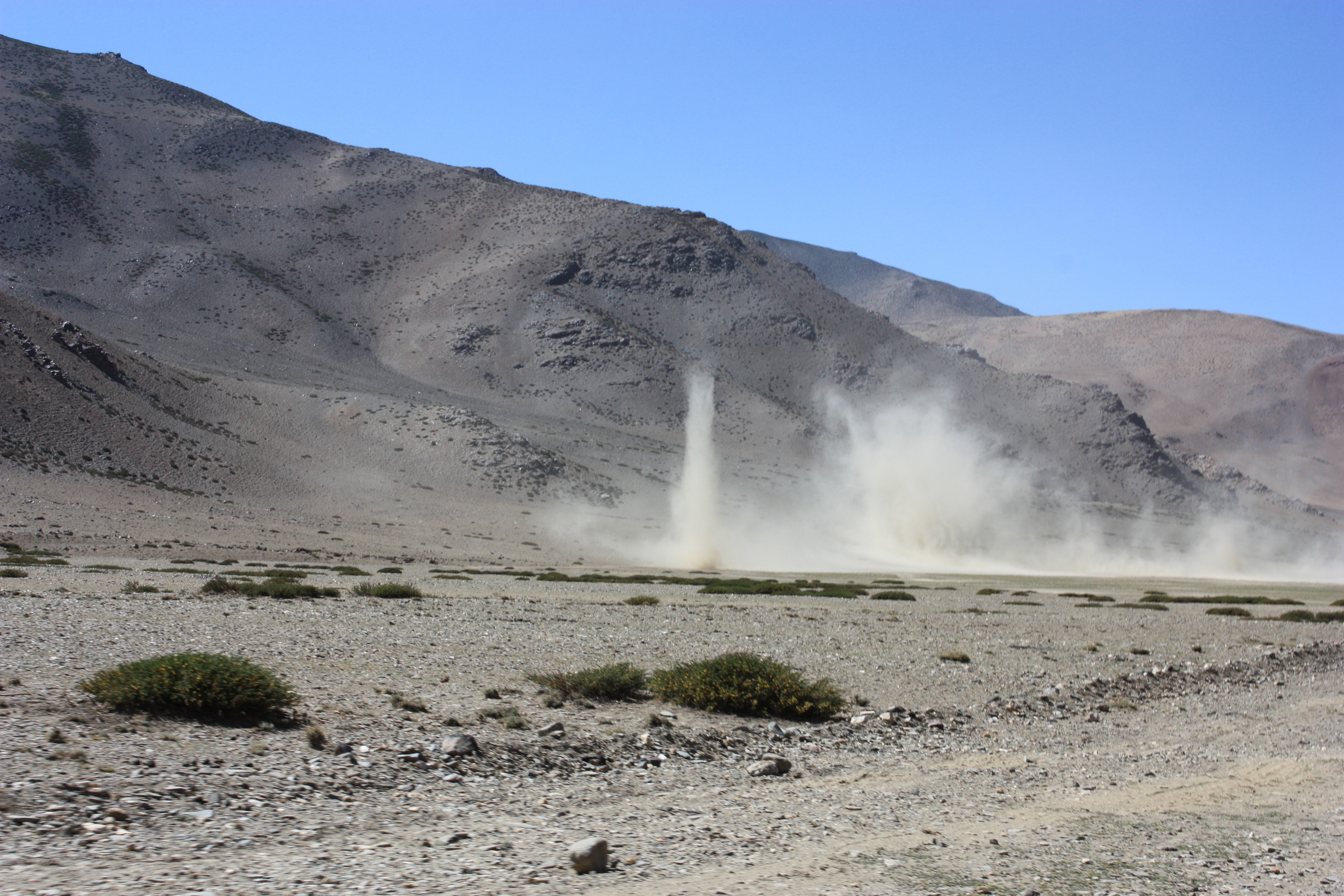
First, we had to brave the dust storms.
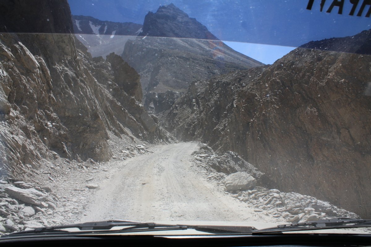
But the craziest moment was probably when the road just ended altogether.
Luckily our driver was skilled in making his own road.
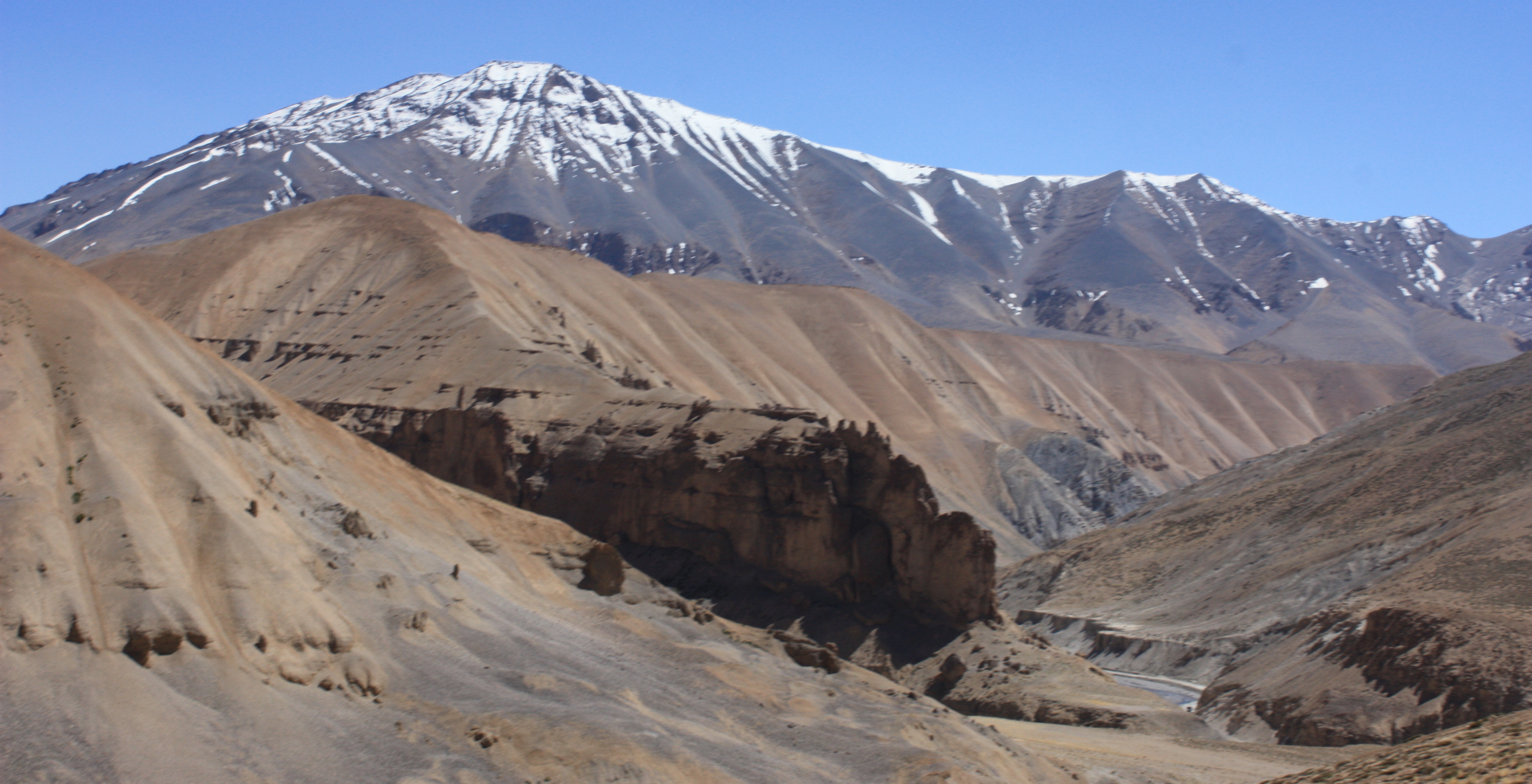
Eventually, we managed to find the road again. And when we finally found it, the colors in the rock had become more vivid.
And this new-found road was serious about taking us up to Tanglang La Pass quickly.
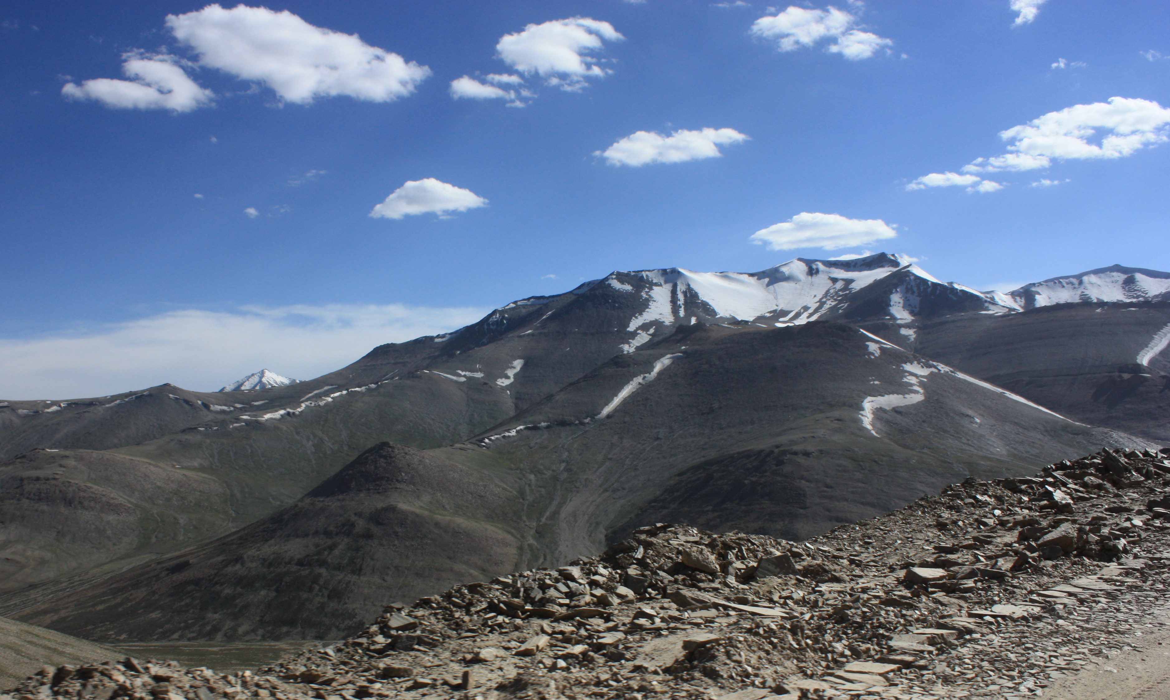
I was determined to get out of the car at the top no matter how little oxygen the air gave me. I breathed deeply to prevent the tingling and numbness that overcame me at the first one. It helped that we had been driving around all day at an average altitude of 15,000 feet. (Yeah, that’s higher than any mountain top in the continental United States).
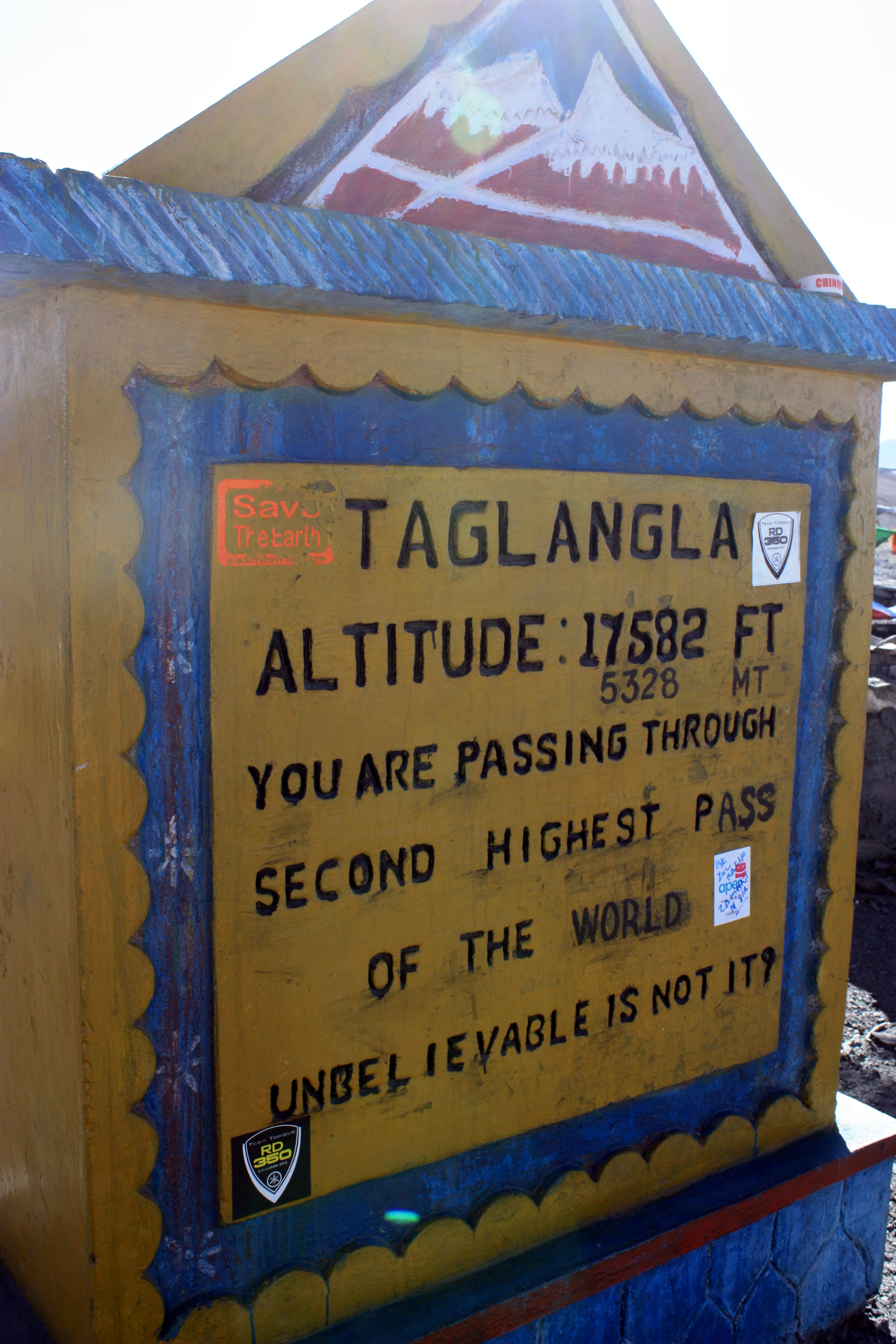
By the time we reached the top, my finger tips had started turning blue, but everything else was ok. I felt like I was on top of the world. (The pictures don’t even kind of do it justice).
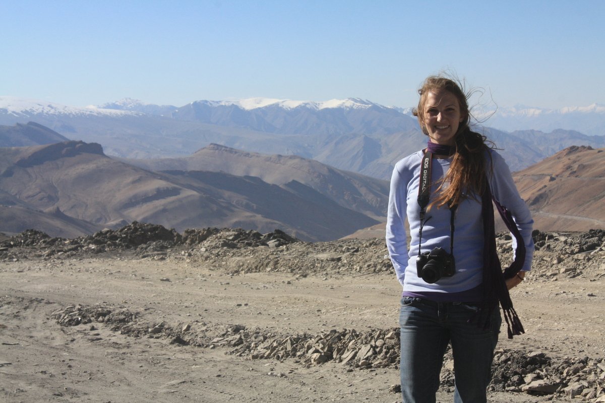
I got out of the car slower than I ever thought possible. I took deep breaths to get as much oxygen as possible. And took probably only one step for each giant breath. After a few minutes, I could walk a little less abnormally, but definitely no sudden movements.

And then we began the drive down.
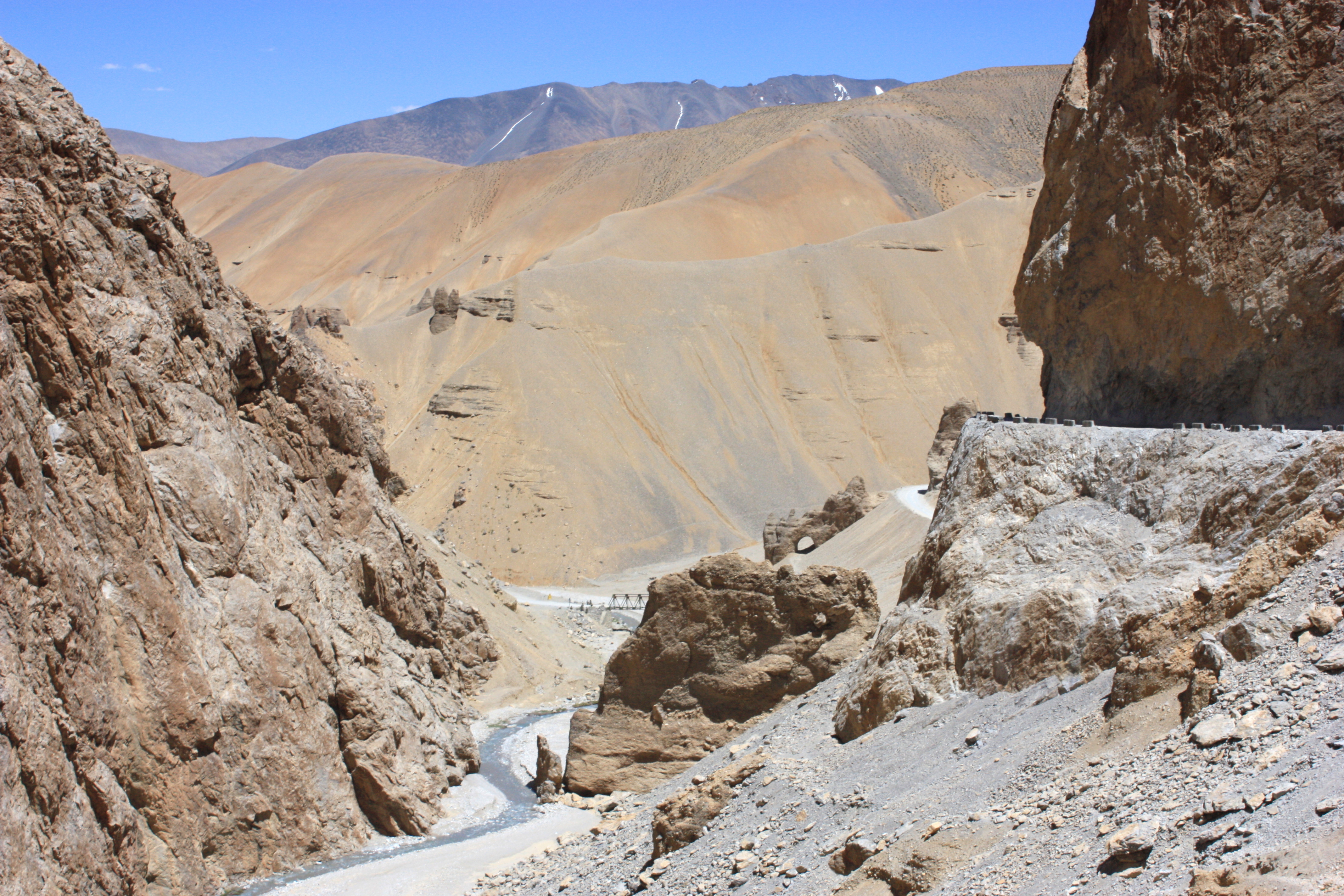
We reached the green grass of the valley below. Leh wasn’t too far…
And we found ourselves in the “Land of 1000 stupas”, a nickname for the Ladakh region.

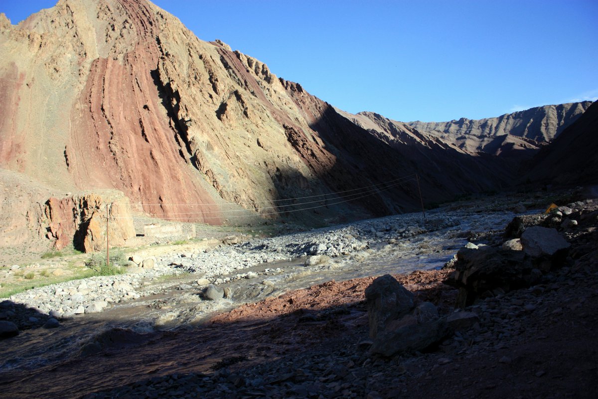
We went through a few more checkpoints and even crossed the ancient Indus River. Unfortunately, I was alseep for that, so I don’t have a picture. But I do have a picture of this nearby river that connects with it eventually. It’s hard to tell in the picture, but this was a point where 2 rivers converged. One with water of a muddy grey color and the other with a dense red clay color. The colors remained separated for some time as the two continued. Eventually they mixed completely.
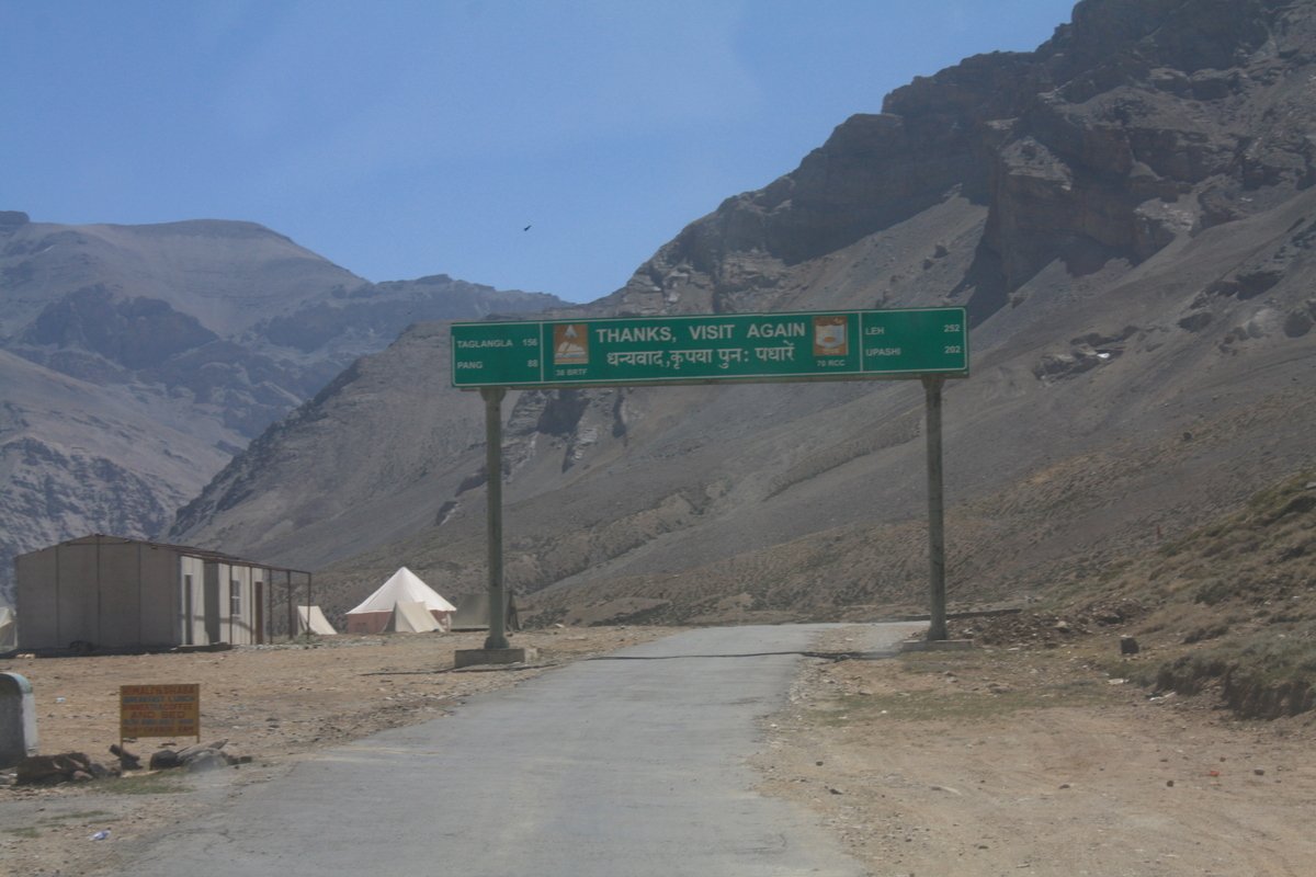
We almost made it to Leh before sunset, but I haven’t even mentioned the flood in a nearby city due to a break in the city water pipes that caused another massive traffic jam that send us winding through back roads and making our own roads once again.
Eventually we made it to Leh. Leh is another story for another time as this post is already way longer than I intended.
